Archive

Monthly Archives: February 2026

Our new monograph on the city of Freetown, Sierra Leone has (finally) been published – open access and you can download it here. It’s a major output stretching to 240 pages across a chunky 250x250mm format and is the third book in our series on sharing the archives of the United Africa Company. The other two books are on Kingsway Stores and The Photocard collection.

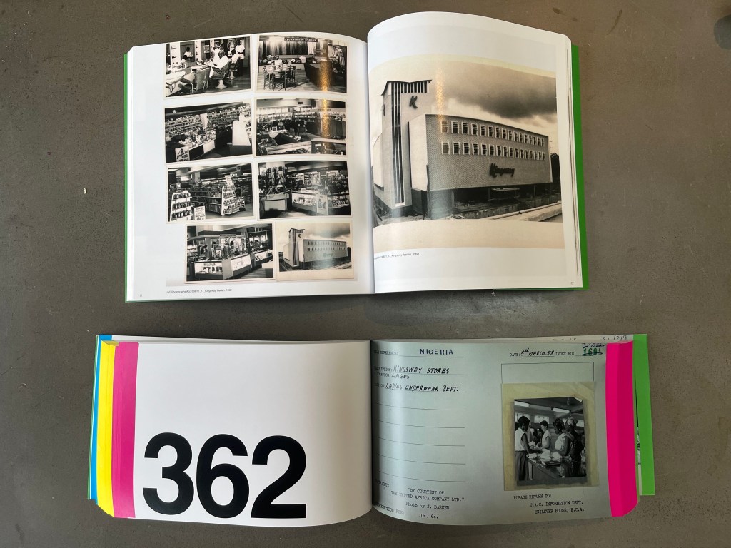
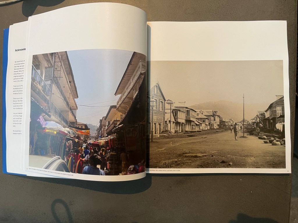
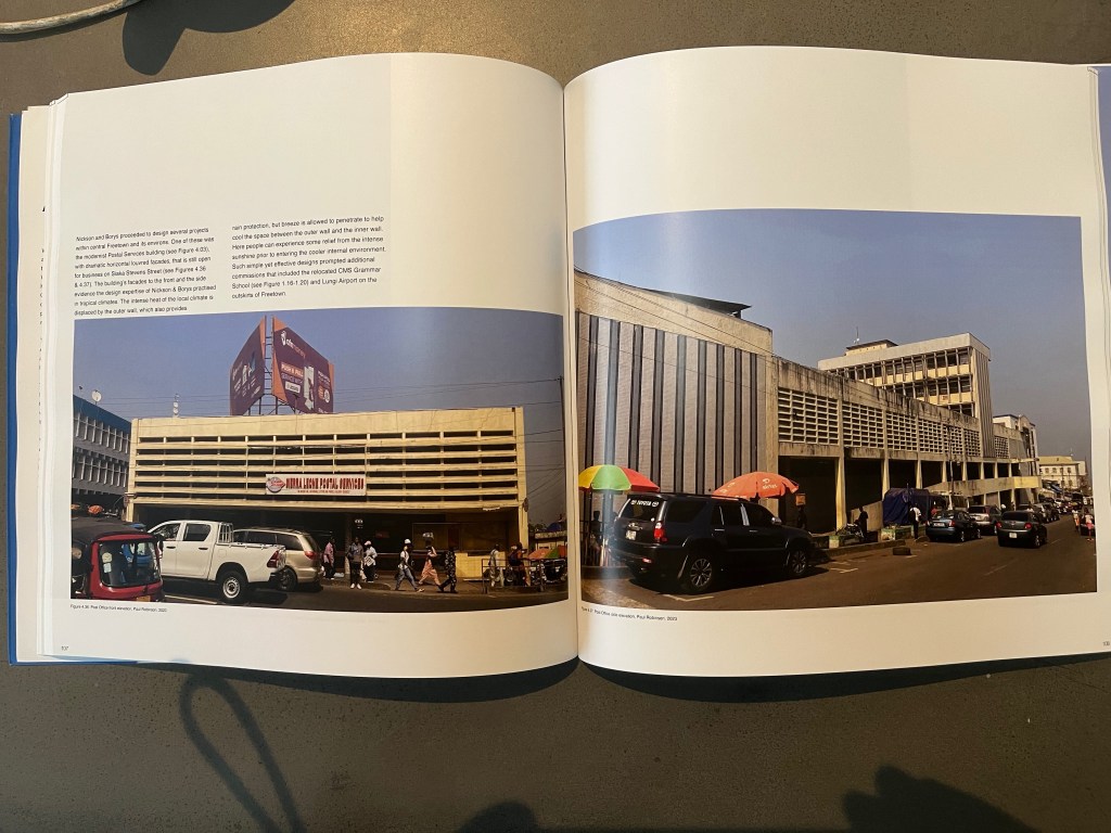
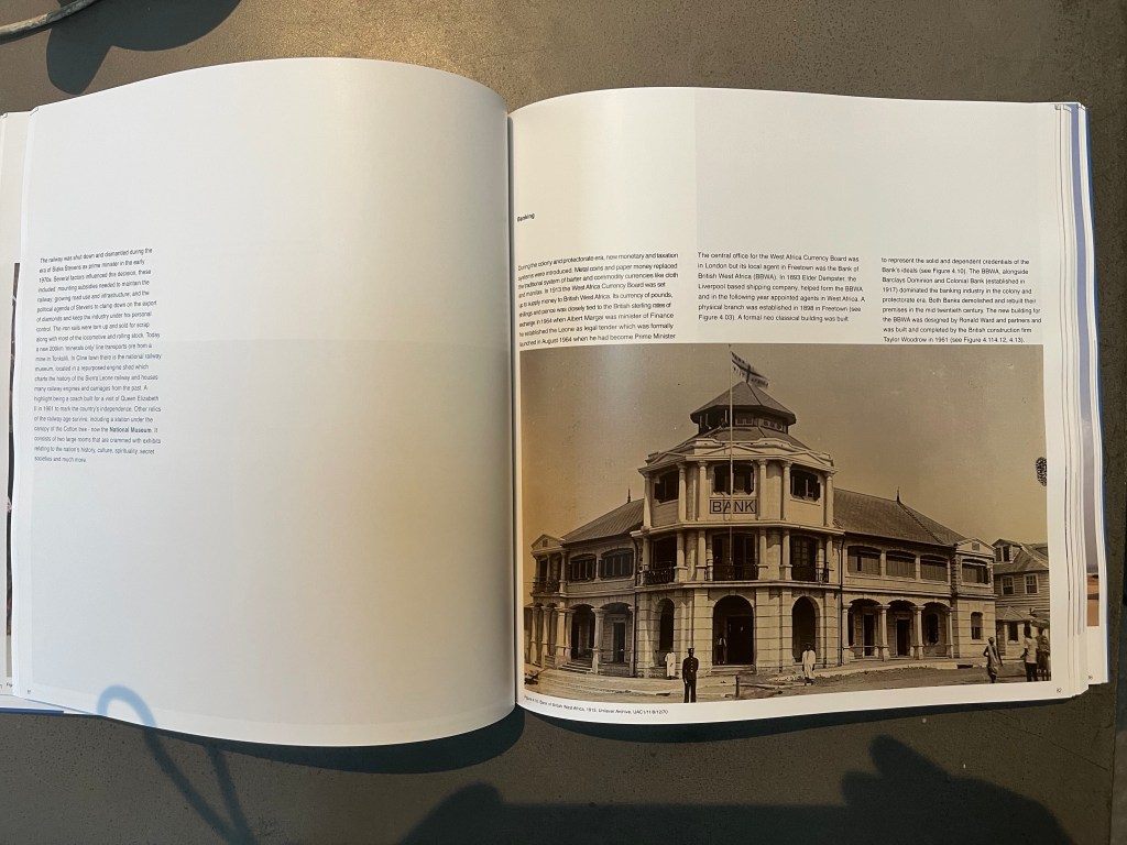
Our approach in Freetown was to identify and write brief historical narratives on the city’s development using archival photographs mainly from the Unilever UAC collection, alongside recent photographs. Archival work took place at Unilever, Bodlean Library, UK National Archives, as well as at Fourah Bay in Freetown – and this informed our fieldwork and photography. The approach is a classic ‘before and after’ set of images with descriptions. There isn’t an architectural guide book or detailed study of Freetown and it’s architecture – which is quite shocking considering the quality of the work and the architects involved (including Nickson and Borys; Jame Cubitt; Ronald Ward and many others….)

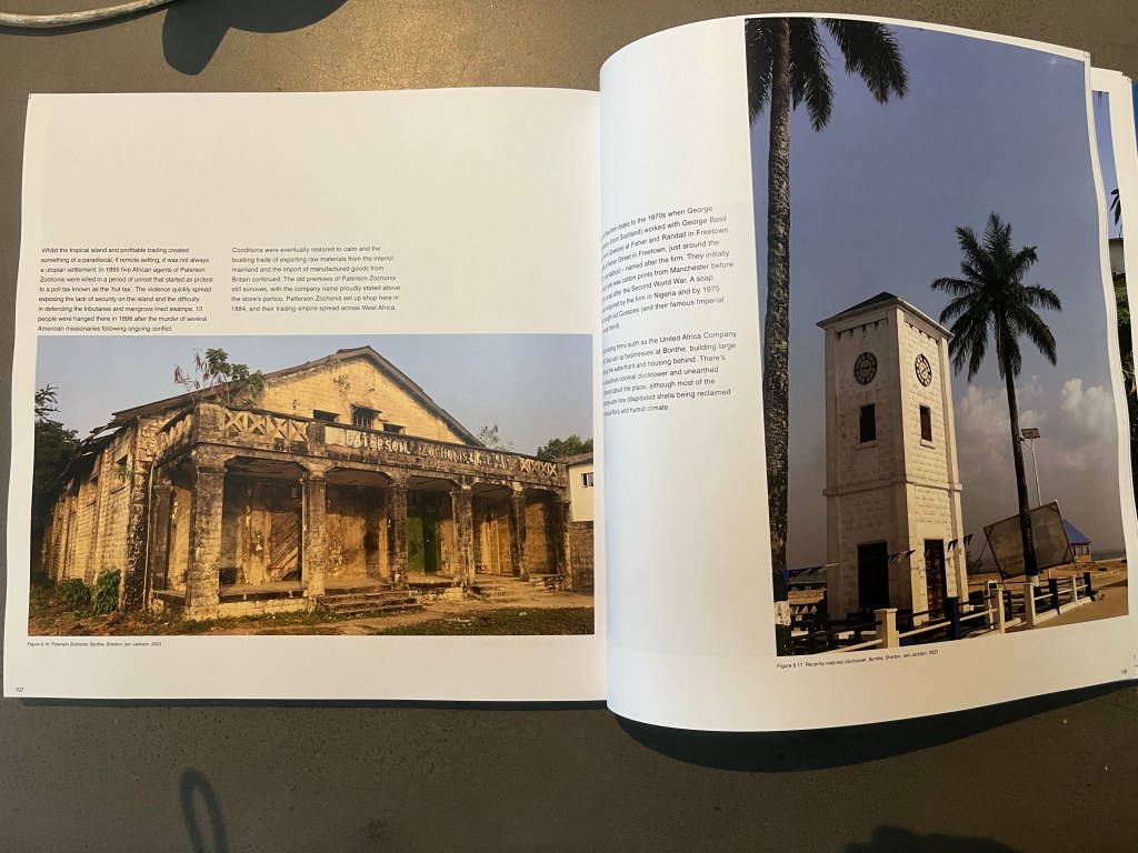
As well as covering the major buildings in the city we include an extended essay on Fourah Bay College, and a write up on Bonthe at Sherbro that we were fortunate to visit. We’re particularly proud of the Bonthe work – and there is certainly a lot more research to undertake into its history and architecture.

Thank you to Dr Noor Ragaban for designing the book – and to Paul Robinson and Ewan Harrison for co-authoring and undertaking the archival and fieldwork with me. As always we’re super grateful to the archivists and historians at UARM – Unilever Archives and Records Management team led by Claire Tunstall.

New research update : Ali, N., Idowu, G. Demolition-driven urbanism and the loss of coastal heritage in Makoko, Lagos. Nat Cities (2026). https://doi.org/10.1038/s44284-026-00411-5

“Makoko is a nineteenth-century fishing neighborhood and major small-scale business hub in Lagos, Nigeria. It is located on prime land in the Yaba local government area. An estimated 250,000 people live there, on top of stilted housing on water and concrete structures on land. Water-based residents are predominantly from the Egun minority group, and land-based residents are largely Yoruba. Following a demolition in 2012, the community’s baales (chiefs) and the Lagos state government signed a memorandum of understanding in 2014. The memorandum of understanding stipulated, among other provisions, the removal of structures within 100 m of the high-voltage power line that traverses Makoko. Although contested, the agreement functioned as a provisional settlement between customary governance and state authority.

Now, this memorandum of understanding has been broken. Since 23 December 2025, the Lagos state government has demolished an estimated 3,000 homesin Makoko’s waterfront areas, extending well beyond the agreed perimeter (based on conversations with residents and video and photographic evidence between 5 and 20 January 2026). The progressive expansion of the demolition zone — from an initially negotiated, legally proscribed 30 m to an arbitrary 522 m from the power line— highlights a governance approach characterized by shifting spatial criteria and insufficient procedural transparency. During the past three years, the stilted houses on the waterfront have steadily expanded towards Third Mainland Bridge, as seen on ArcGIS — which does not explain the transgression of the agreed perimeter. There are only speculations about why the government broke the memorandum of understanding, which held for almost 11 years.”

Author information

  1. Nura Ali, Liverpool School of Architecture, University of Liverpool, Liverpool, UKNura Ali
  2. Gowon Idowu, Traditional medicine practitioner, Lagos, Nigeria, Gowon Idowu

Read the full article here: https://rdcu.be/e5ECP