Archive

Monthly Archives: January 2017

Adjena Revisited

Ola Uduku writes;

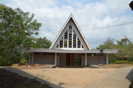
It was a long and dusty journey, we soon understood why the taxi wouldn’t haggle down from the amount he quoted. The road definitely existed, it was just in very poor condition and work was being done near the end of the journey to Adjena to re-grade the laterite. We finally pulled into a gathering of housing on each side and slowed down, I said this looks likes ‘tropical designed housing’.

dsc_0456

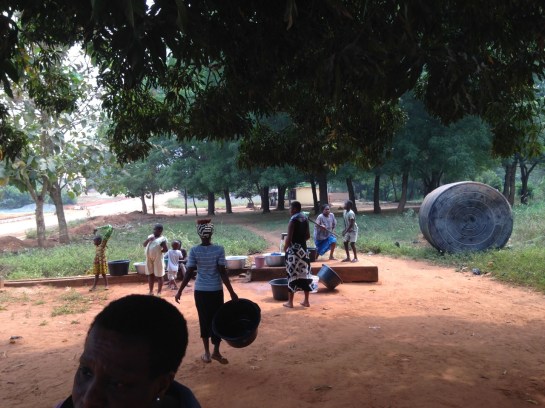
A hand-operated water pump caught our eyes and we watched a small gathering of  women and children pump up their water into buckets and containers and then take them away for use.  We walked to two elderly men dozing under a tree and asked the throng if we could wake one up.

img_0727

‘Is the Adjena resettlement area?’, we asked.

‘yes’ came the reply.

Our first informant was in his eighties and  had arrived when the first set of resettled villagers were moved to the site in 1957. He explained that there was a school further along and more housing.

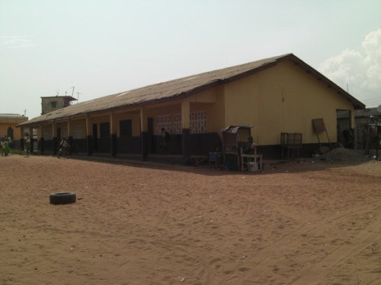
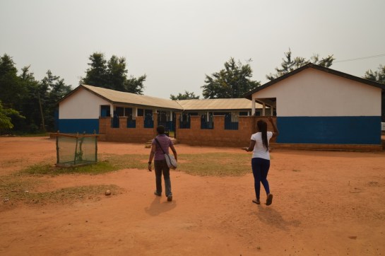
We went further into the clearing and hit gold – a small school designed around a courtyard to specific tropical standards. Windows were deep and allowed light to penetrate through the classrooms, and the verandas were ample to enable their use in teaching.  The school was foregrounded by a number of trees which seem to have been planted to a specific format, unfortunately they seemed to be dying, but they still helped frame the school and looked as if they were very much part of the school grounds.

dsc_0439

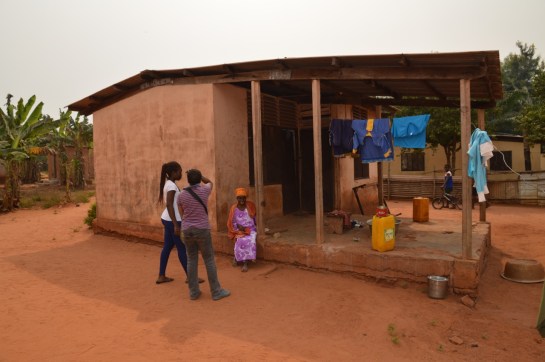
Moving on from the school we came to a clearing with a designed kitchen–cooking area central to a number of small dwellings. We stopped and talked to Agnes, whom we asked about what she remembered about moving to Adjena. She immediately recounted that she had been 27 when the move had taken place and she was 87 now. A quick date check confirmed that these dates tallied with the move of the settlement in the Volta valley to Adjena. As we chatted with her on the step to the kitchen she explained that she preferred the new settlement to the old as the new buildings were  ‘Cortex’, the name given to the company who built the settlement made up a concrete frame with infill breeze block walls.

dsc_0443

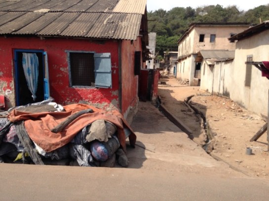
We passed a number of small dwellings designed as part of the scheme. All dwellings now had electricity with television sets to prove it, however water was only available via the standpipes that we had seen when we walked into the settlement. The communal WCs did not seem to well used, one supposes that in this very remote rural area this option was unlikely to be popular.

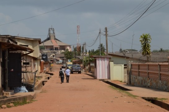
For a resettlement scheme approaching its 6th decade Adjena was in good condition, it now had a junior secondary school and the road carried both the electricity lines and also the mobile phone masts. The road also ran through to the community council offices and there were other settlements which were now part of the greater extended Adjena community.

Developments were coming to Adjena, and we had been made welcome guests to this sleepy, yet thriving community. What would Leo De Syllas and the other designers of the then New Adjena think of their creation more than half a century on? An understated success we’d say as we made our dusty way back to the town.


Field Work: Axim and Dixcove

Heading west from Takoradi along the coast-road towards Côte d’Ivoire there are a number of fishing towns and natural harbours, such as Axim and Dixcote.

img_0697

Dixcove Harbour

IMG_0692.jpg

Fishing Boats at Dixcove

Axim was a major port during the early 20thC, exporting £250,000 worth of goods in 1913, and the mail boat from Liverpool (as well as ships from the US, Germany and Belgium) called every 10-15 days before heading on to Sekondi. Before the British occupied the Fort at Axim (Fort St. Anthony) it was held built by the Portuguese in 1515 and then captured by the Dutch from 1642. The Fort was conceded to Britain, along with the other Dutch forts east of Elmina on the 6th April 1872.

A European hospital was established in the town in 1901, and the British Bank of West Africa opened a branch, having traded in Accra from 1897. There are still some colonial buildings to be found, and a photograph of the District Commissioner’s bungalow (c.1914) is held in the UK National Archives.

axim-bungalow

Type B Public Works Department Bungalow in Axim

Besides the Fort, the Quandahor Building dominates the town from its elevated position. The building (according to some sources) was built in the 1920s, but with what purpose and by whom?

dsc_0426

Quandahor Building in Axim

Nearby Dixcove also has its fort (macabrely named Fort Metal Cross after the slave branding iron used there) and the town still retains its thriving fishing industry. The fortress was constructed from 1683 by the Royal African Company and continues to resemble the 1806 print below. Needless to say, it is a harrowing structure, and a surviving relic of what must be one of the lowest points of British history.  By 1868 the Fort was under Dutch control, before being returned to the British just four years later. It was made a World Heritage Site in 1979 and has recently been inhabited by an Englishman intent on refurbishing the place.

phpthumb_generated_thumbnailjpg-2

1806 Print depicting Dixcove

DSC_0414.jpg

Dixcove Fortress

It was only in 1911 that a Customs Warehouse was completed and a market shed was erected in the Dixcove – is the image below the customs warehouse? A few other Colonial period buildings survive and we will endeavour to find out more about this fascinating place.

dsc_0423

The Customs Warehouse in Dixcove?

An Update from Takoradi, Ghana Part 2

The docks and rail infrastructure of Takoradi was the impetus behind its rapid expansion from a small village to a major town. Construction commenced after WW1, but before this took place, it was neighbouring Sekondi that dominated the area with its grand houses, trading offices and the plush Metropole Hotel. The Dutch established Fort Orange there from 1670 and the natural harbour provided a suitable place for light vessels to shelter whilst the surf boats manned by the Kru people brought goods and people ashore.

evernote-snapshot-20160720-121210-copy

The Metropole Hotel, Sekondi

There is some rich architectural heritage in this town, and clear evidence of a once prospering settlement full of traders and merchants. Those days are clearly gone.

We started with two schools, the first called Fijai, captured here by the UK National Archives Africa through a lens. Then onto St. John’s, again the vintage photo below shows the clean lines of the school, when constructed c. 1955.


dsc_0383

St. John’s School, Sekondi

There have been further additions to the school including the striking church, donated by a Wisconsin family , with its large A-line structural frame,  finely detailed concrete casting, wooden ceiling and pre-cast screening. Next to St. John’s is Adiembra housing estate. There were revisions proposed for Adiembra in the 1944 Town Planning report made by Maxwell Fry and Jane Drew, but it is difficult to ascertain what impact this report made on the area, if any. However, we did spot some standpipes and washing stations that resemble those proposed by Fry and Drew in their manual, Village Housing in the Tropics, so perhaps this is evidence of their involvement.

dsc_0376

The Church at St. John’s School

We went onto the main street of Sekondi where the Post Office is located. We discussed this building in our chapter in Bremner’s Architecture and Urbanism in the British Empire, but were now shocked to see how the exquisite timber counter had been painted in bright blue gloss – destroying the previous display of tropical hardwoods. The rest of the street has only gotten worse since our last visit, with many of the former colonial buildings on the brink of collapse. Absent landlords coupled with a shrinking economy has left these structures vulnerable and economically unviable. Further sad news must be reported, as the modernist Sekondi Regional Library has recently been demolished and replaced with a new library.

Our final visit in Sekondi was to the coastal-road village of Ekuasie, laid out in 1912. This was an early attempt at providing worker housing and adopts the familiar grid iron street format, although far more loosely imposed than similar schemes elsewhere (such as Korle Gono). There are some later and grander additions to this village, including a set of houses from the mid 1950s.

img_0663

Ekuasie Housing Estate

We returned to Takoradi and explored the workers’ estate, mentioned in the PRAAD archives as the ‘labourers housing and school’ at the Zongo area. This is still a thriving area, Hausa was heard being spoken and the tiny streets eventually lead to a playground-cum-village square, overlooked by the Islamic school and Mosque.

cimg5294

Takoradi Zongo School

An Update from Takoradi, Ghana

We started at the Takoradi Train Station, completed by 1928 as part of the coastal rail and docklands development. The train lines were initially constructed to transport cash crops, minerals and metals from the northern agricultural and mining districts to the awaiting ships, sheltered in the newly constructed breakwater and deep water harbour. When we visited in 2012 the train station was completely derelict and not in use. Today we found it carefully restored and new tracks laid. The plan is to reuse it for a local transport network. We walked up the hill to the small commercial district made up of international banks and a post and telegrams office. The mishmash of styles reveals the incremental development, as well as the fierce competition between the banks eager to differentiate themselves from the competition.

The former European hospital clock tower up on the hill overlooks the banks and docklands, as well as benefiting from the cooling sea breeze.

We drove to the 1920s part of Takoradi, a major new town extension that was built to accompany the docks development of that time. This portion of the town was primarily for the African population, although it also contains the Lasdun designed Bank of Ghana [built 1957]. Lasdun was also the architect of the National Museum in Accra. The bank was vacant when we visited in 2012, but now it stands in a state of complete dereliction, its fine materials and fixings being stripped from the building. This is a real tragedy. It was once an outstanding building, recorded in the Architecture journals of the day and surely one of Lasdun’s greatest works from this period.

img_0633

Somewhat downbeat, we bid farewell to the bank, and made our way to the rond-point in the middle of the town. The map was deceiving, as this was built as a major market place – our driver told us it was one of the largest markets in West Africa. It had the feel of Kariakoo market  in Dar es Salaam, and also contains a delightful little PWD post office with its signage graphics still intact.

Adjacent to the market is Amanful Village. Laid out in 1922-3 it is a mixed use area of housing and commercial properties. The basic PWD-type houses and layout remained in place, but more wealthy owners had transformed much of the upper part of the estate to suburban housing.

We then went to the Takoradi Technical Institute, shown above (Left, b+w) in the Africa Through a Lens Collection at the UK National Archives. There is a forcefulness to this scheme that takes the familiar two storey gallery access format, and emboldens into more ‘clunky’ yet determined architectural-structural forms.

dsc_0363

Nearby is the Effiekuma housing and the Effia Nkwanta hospital. The hospital has evolved overtime from a European hospital-cum-sanatorium in the colonial period, to a major health provider today. The careful layering and response to the site contours offers delightful views as well as a most welcome breeze to all the small structures that each have a view of the docks. At the top of the hill is a large brutalist extension that dates from c. late 1960s early 1970s. But who designed it?