Call for participation Journée d’étude sur l’architecture et l’urbanisme au Maroc après l’indépendance (1956-1986) 20th February 2024, Centre Jacques Berque, Rabat Deadline (french or english): 30th September 2023
The newly established Réseau de recherche sur l’histoire de l’architecture au Maroc – RHAM (rham.hypotheses.org) launches a call for participation to the Symposium: ‘L’architecture et l’urbanisme au Maroc après l’indépendance (1956-1986). Trajectoires d’acteurs et circulations de savoirs’.
“Cette journée d’étude se concentre sur une période spécifique de l’histoire du Maroc : les trois décennies qui ont suivi l’indépendance du Maroc, de 1956 à 1986. Cette période, qui demeure encore largement sous-explorée au regard de la littérature produite sur la période coloniale, suscite désormais un intérêt croissant. Fort de ce constat, la première journée d’étude du RHAM vise à faire se croiser et se rencontrer ces différentes manières d’aborder l’histoire de l’architecture, du paysage, de l’urbanisme et de l’aménagement du territoire au lendemain de l’indépendance, en mettant en évidence des matériaux de recherche inédits“
For more info, see the call for participation here.
The latest issue of Planning Perspectives investigates the role international organizations such as the United Nations, the World Bank, and the Red Cross played in the architecture discourse and the rise of ‘global experts’. The collection of articles, co-edited by Filippo De Dominicis and Ines Tolic, explores development plans and housing schemes, but also events related to dissemination or training implemented especially, but not exclusively, during the decolonisation phase in the 1950s and 1960s and the so called ‘development decades’.
In an article published in open access which I co-authored with Axel Fisher, Foreign aid for rural development: village design and planning in post-independence Morocco, we asked ourselves to what degree the work of architects and urban planners was influenced by the shifting and competing development agendas of the United Nations’ technical assistance, the FAO – Food and Agriculture Organization, and the World Bank. We start from the analysis of architects’ involvement in three rather diverse rural development projects implemented in Morocco after the 1956 independence in which community development and infrastructure-driven approaches overlapped. In doing so, we question the architects’ capacity to translate the strategic objectives in functional programmes, and to make ‘spatialized politics’ most vividly palpable.
An annotated diary of my visit to the Democratic Republic of Congo: a brief stop in Kinshasa before flying to Kisangani and then, following the Congo River, a preliminary exploration of one the regions where the Huileries du Congo Belge – HCB had established its oil palm plantations.
This trip would have not been possible without the help of >>Istituto per la Bioeconomia – CNR and Forets (Formation et Recherche dans le Tshopo) – >>Cifor (Centre for International Forestry Research).
May 2022
Kinshasa — Me and Ottaviano landed in Kinshasa on a Monday morning. I had never crossed the Equator before.
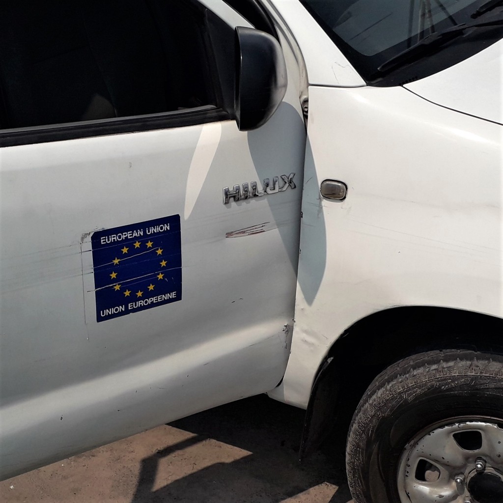
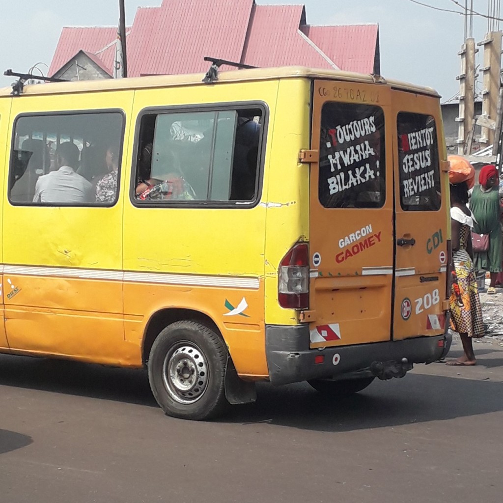
Papa Victor is waiting for us outside on a white Toyota jeep with a EU flag on the door and dents and scratches on all sides. A description that would fit most of the vehicles I travelled in during this trip and, as I came to discover, a stereotype for Westerners in this country. Victor is a tall, pleasant man who talk and laugh quietly even when we plunge into the suffocating traffic of Kinshasa. The 25 kilometers between the airport and my hotel in Gombe are an endless sequence of taxis, yellow Wokswagen vans running with the doors open to bring some air to the passengers squeezed inside, a multitude of weva moto-taxis, and trucks covered in sticky black dust.
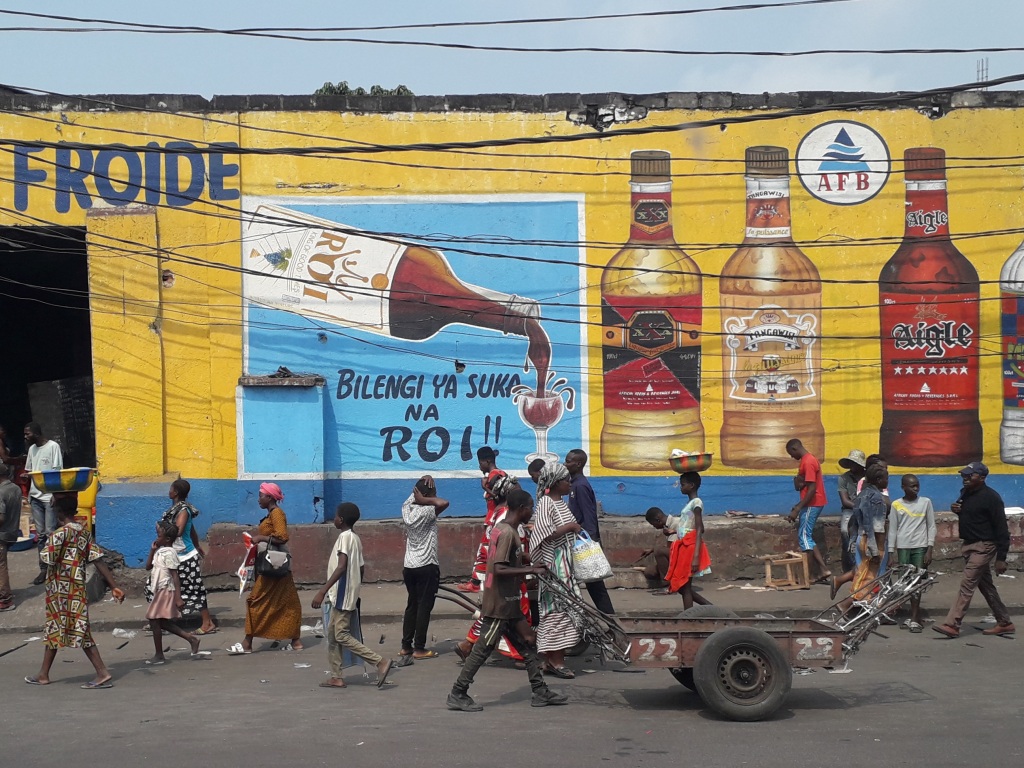
The two days in Kinshasa are chaotic. We meet with some people and don’t see much. I watch street scenes, buildings, and billboards passing by from the window of Victor’s car.
During the last night in the city, I meet my old friends and former colleagues Raphael, Paul, and Pietro – who became a real Kinois in the meanwhile. From the hall of my overpriced hotel Raphael, tells me with his usually sharp irony: “Il faut que tu sors de cette Leopoldville”. And so we drive away, leaving Gombe behind us. Paul, who has a thing for infrastructures, gives us a lecture from behind the wheel of his car while we cross the city. Boulevard du 30 Juin, which originally connected the two Stanley’s times settlements of Kintambo Ngaliema and Nshasha, and later became the first of the large avenues of the colonial capital [>>Kinshasa Then and Now]. Avenue des Huileries, pointing to the area formerly occupied by the Huileries du Congo Belge, now hosting its successor Marsavco.. And then, Matonge, the neighborhooud that everyone here calls the musical capital of the DRC. After having lived for years few hundred meters from Matonge (Brussels) – a product of Congolese diaspora in Belgium – I finally get to see its original counterpart.
It’s early in the morning when we leave again for the airport but the city is well awake.
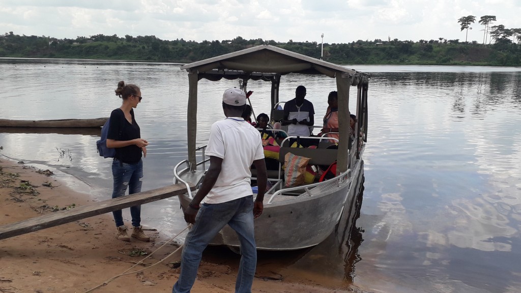
Congo River — After landing in Kisangani we are brought directly to the dock on the Tshopo river. The beach, as docks are locally called borrowing the word from English, is just a sandy stretch where dugout canoes and boats come ashore. We get on board of the canot rapide that Cifor made available for us and, following the Tshopo and Lindi rivers, we finally reach the Congo. Few kilometres upriver, the Wagenia/Boyoma falls, a one-hundred kilometres long sequence of cataracts, make the river impossible to navigate. After the falls, the Congo begins its ‘quiet’ descent of the 1,700 navigable kilometers dividing the place where we are navigating now from Kinshasa’s Pool Malebo before rushing again, through impressive rapids, up to Matadi and to the Ocean.
From this moment on, this broad, magnificient river, with its banks covered in thick vegetation, becomes the silent protagonist of the travel.
Moving along the river coast, the canot go past busy docks where pirogues – simple boats built by carving a single tree trunk and manouvred by one or two rowers – carry large, white sacks of coal to sell. Apart from our boat and the infrequent barges, the river is populated by these small crafts and by the noisy baleinières (‘whaler’), a wooden boat used for goods transport. Besides being painfully slow, the two half-sunken relics I could spot along the way, testify the scarce reliabilty of these bizarrely named boats.
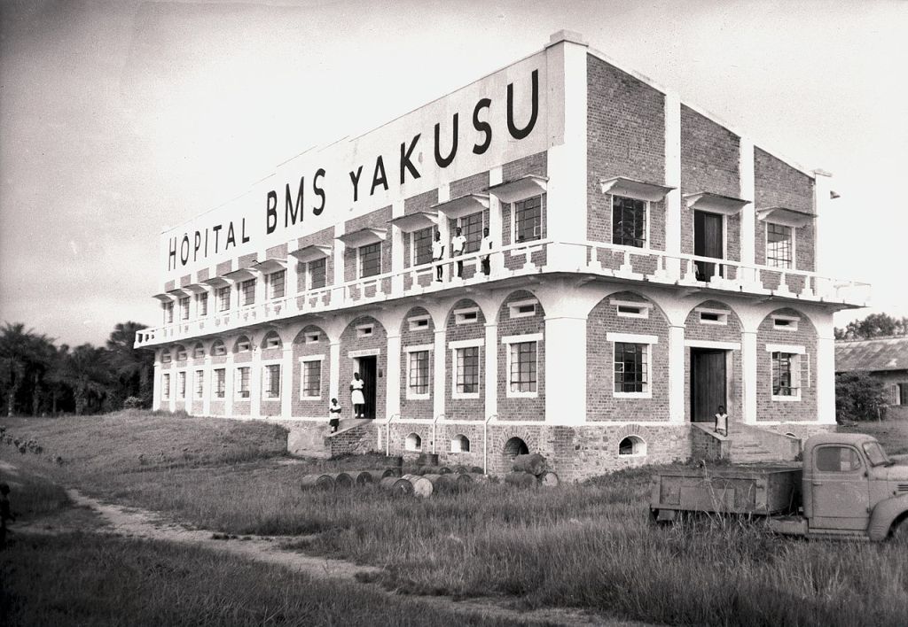
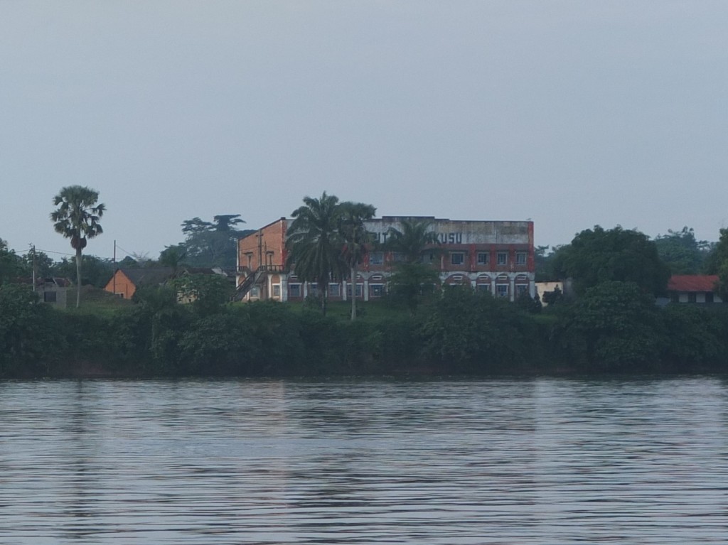
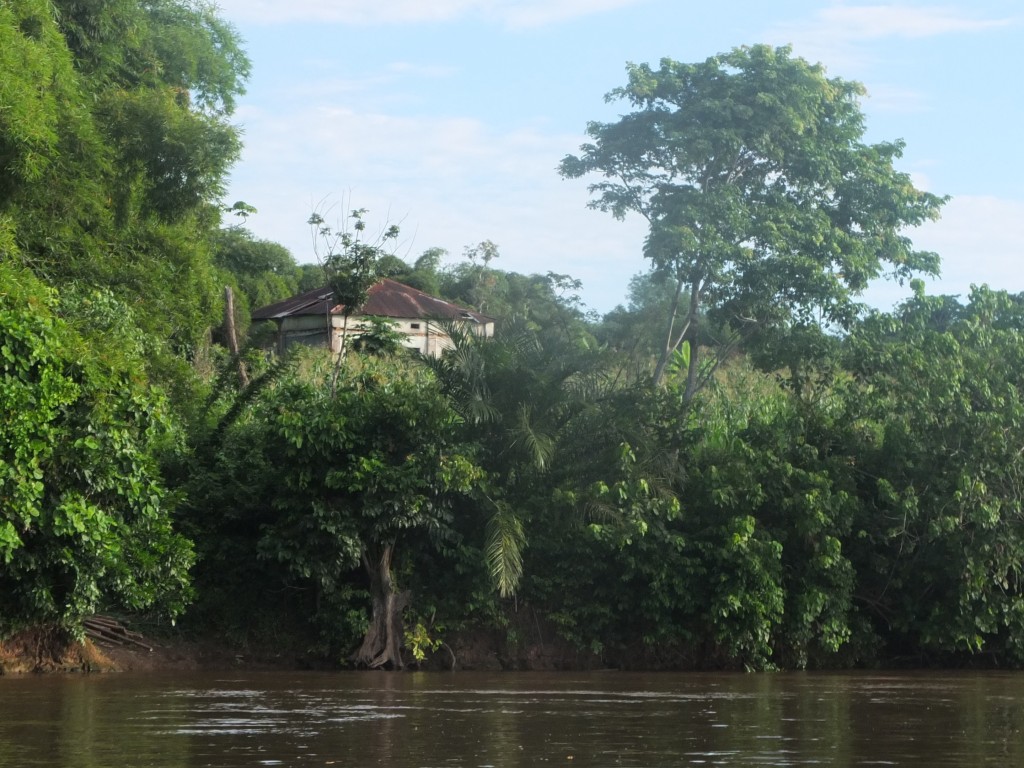
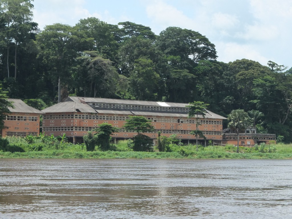
From the canot, on the right bank, flanked by colonial villas, I spot the prominent facade of the Yakusu hospital, a now run-down gem of the Baptist Missionary Society in the Belgian Congo and an important institution for the educational and medical history of the country [Nancy Rose Hunt,>>Colonial lexicon: of birth ritual, medicalization, and mobility in the Congo].
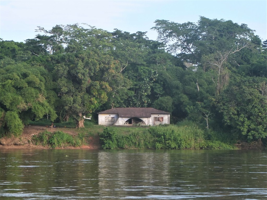
Further down the river, the Belgika, a private island owned by the heirs of a high-rank military chief under Mobutu dictatorship. Our boat speeds close to the coast; the waves agitate the fishermen’s pirogues moving under the branches of leaning trees. The shape of old buildings with porches facing the river vanishes rapidly behind the vegetation. >>During the colonial time, the island was a coffee and rubber plantation owned by the Comptoir Colonial Belgika. The company realised barracks for the workers and villas for the European technicians and now, half a century after it abrupty left the island, those buildings are occupied by the few hundred people still living on the island or are left in disrepair.
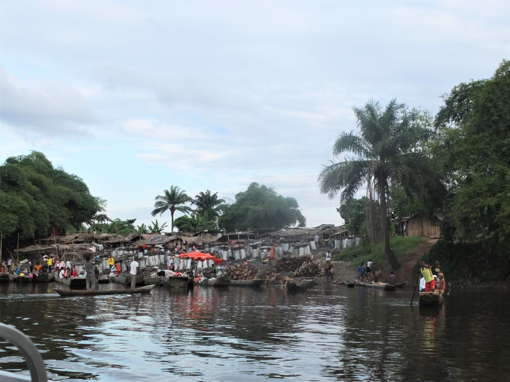
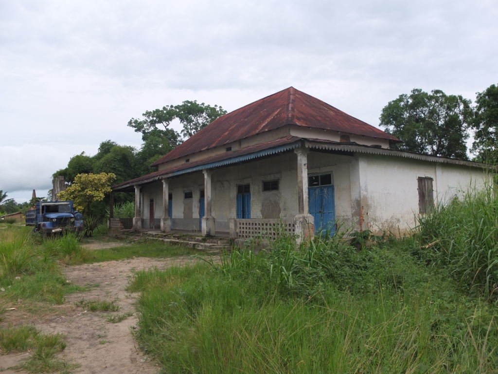
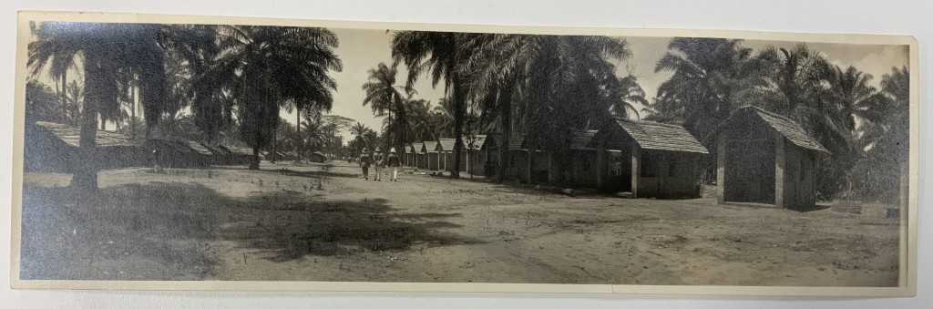
Yanonge — 50 kilometers downriver to Kisangani, we disembark in Yanonge, a small town built around a river dock and its market; a commercial gate to the river for the backland Opala territory and the Turumbu people. Up from the dock, over the steep river banks, I can read dates and names of European firms inscribed on the front of wharehouses now surrounded by the wooden stands of the weekly market. Along the riverfront, the traders’ villas and shops are almost untouched. Guélor, who shows me the place, lives in one of them with his family of five. The rest of the town is made of single-floor brick houses – the construction material coming from the local furnaces – and by simple clay, wood and straw houses. Outside the busy market area and the two main roads, people walk calmly in the shade of the many acacia and palm trees.
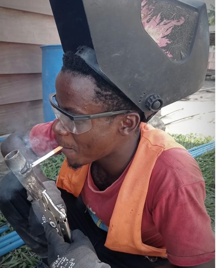
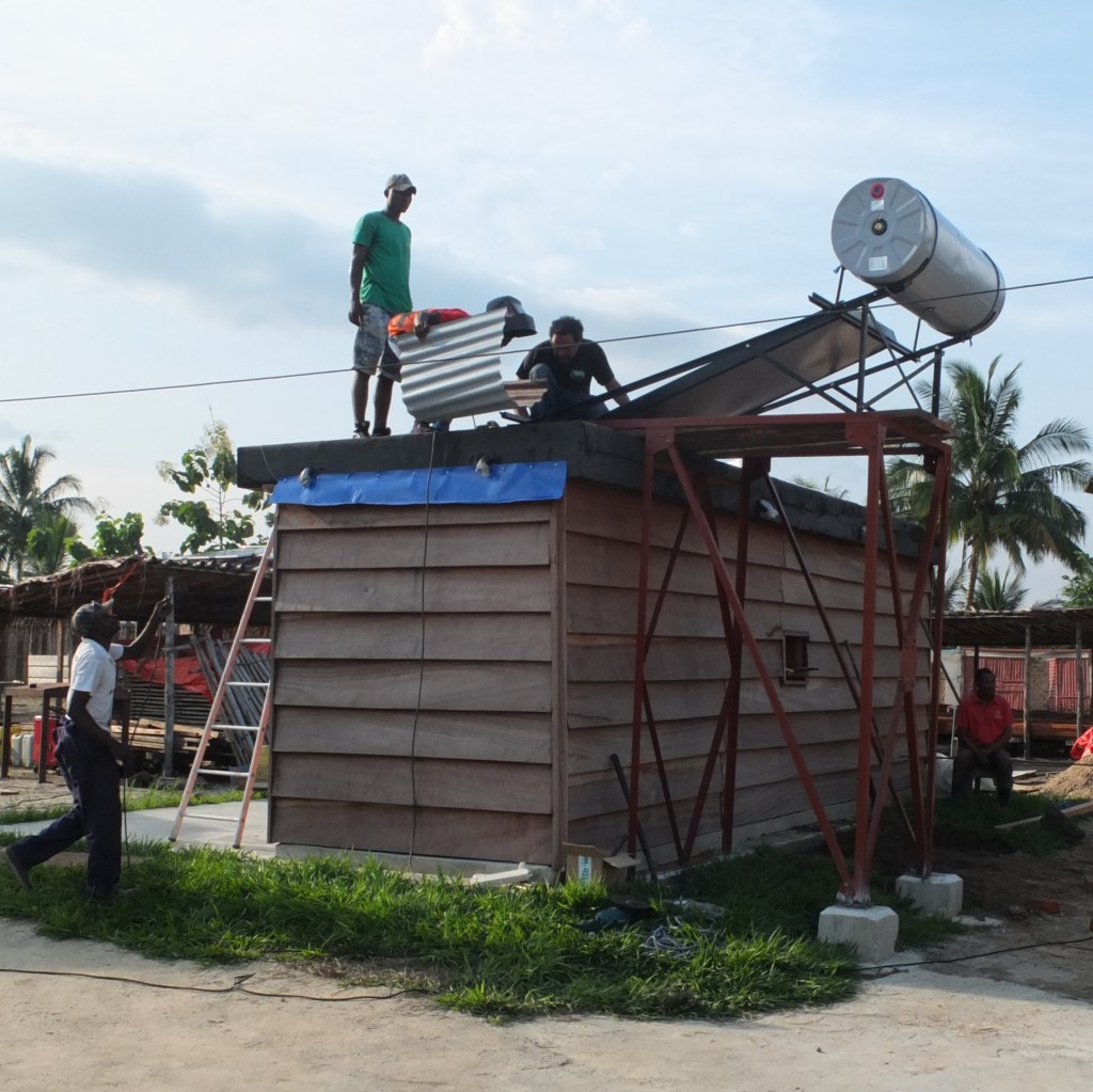
Since few years, Cifor established one of its bases in the town and carries our reforestation, agricultural and local development projects. Silvia, among the many other things, coordinates the construction of a small sawmill. A solar drying kiln is close to completion and an oddly sorted team of Congolese and Italians welds metal, cuts wood boards, make electrical and hydraulic connections, rushing to complete it before our departure. (My contribution to the works is barely symbolic). The aim is to prepare the way for a locally managed, and economically sustainable activity which, allowing to meet the quality standards required for exporting wood, would eventually offer a credible alternative to illegal logging [>>Forets]
Fabrice lighting a cigarette with a welded piece / Vittorio at work: photos O.A.
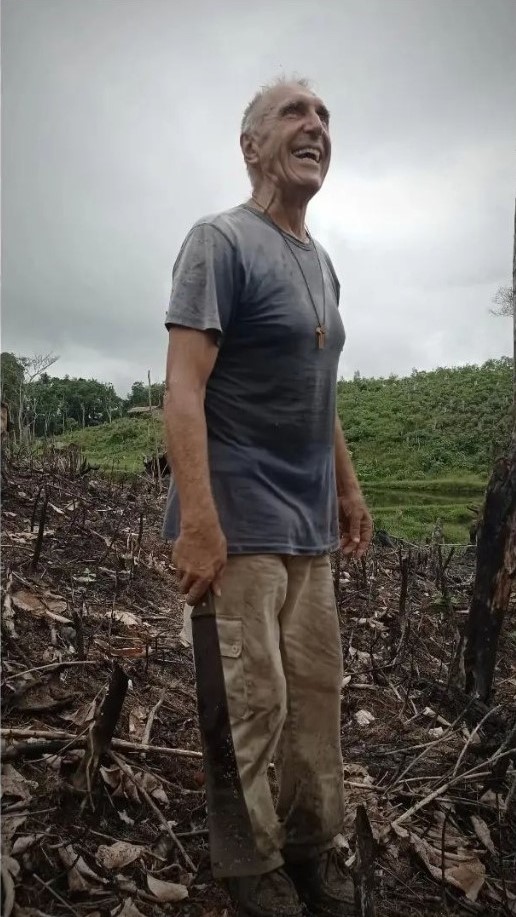
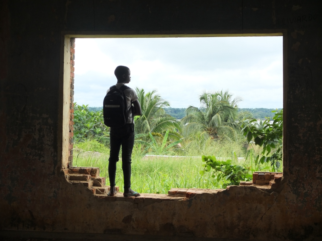
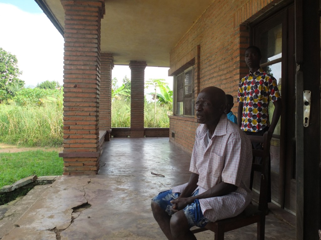
During our days in Yanonge we stay at the local Catholic mission. Outside cities, missions often offers one of the few reasonably comfortable accommodations and in Yanonge, the Comboni community also gives the occasion for some peculiar encounters. Our early equatorial evenings are filled by the accounts of Father Vittorio, a truly remarkable character who spent 50 years in the Congolese rainforest, has unlimited energies, and a passion for >>improbable projects. When sitting in front of the usual plate of rice, pondu and tilapia, he starts talking and so I put my recorder on the table. I collect hours and hours of his improvised local history monologues in which he mixes personal memories with the accounts of the people among whom he have lived. “There weren’t many books in the places I have lived – he keeps saying, not without theatricality – but people love to talk to good listeners.”
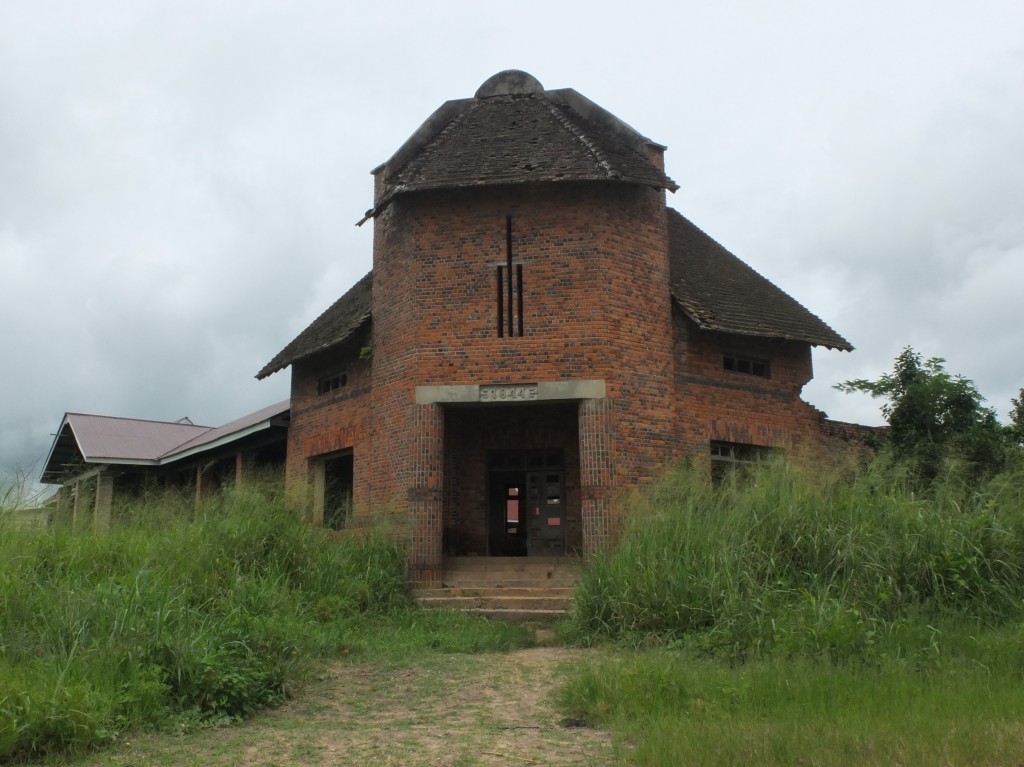
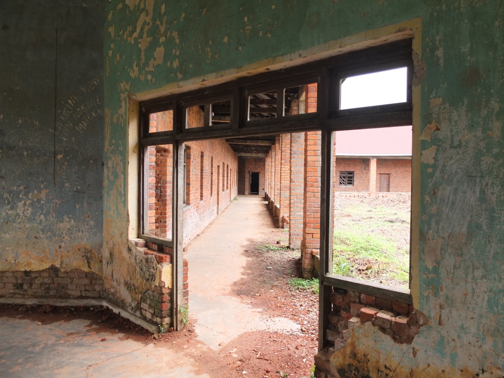
Here, the buildings have stories to tell too. The religious mission was established in the early days of the Belgian Congo and abandoned for decades after the brutal incursion in the convent by the Simba rebels in 1964. The concrete lintel mounted on rounded jambs – a motive that many times I saw in Brussels – at the entrance of what was the mission’s carpentry school is marked with the date ‘1944’. Behind the art-deco facade, a large room covered with an overly complex wooden trusses system. The three wings with porches on both sides form a courtyard and are in ruin. Part of the high-pitched roofs – a large ventilated chamber was originally left on top of classrooms to protect them from the heat – had been replaced; the rest had crumbled. Kids are everywhere, playing among the teetering walls. Our not so credible recommendations to stay away from the crumbling structures are (quite understandably) ignored. The mostly disappeared wood worshop is now a favourite spot for discreet nocturnal encounters and Paolo says that the large wood cutting machine built in Belgium in the 1940s was still bolted to the floor until not so long ago.
Private archive Vittorio Farronato
Next to this complex, the church and the old convent – now used as a school. The convent has a familiar shape that I had never had the chance to look closely before. A single-floor building – despite what the view from the outside may suggest – with a central corridor cutting longitudinally, facade-to-facade, through the building and rooms on both sides. Seen in cross-section, the corridor with openings placed at the ceiling level was meant to extract the hot air through natural ventilation. Next to this group of buildings and most probably coeval, a structure carrying a sign MATERNITE’ and two groups of identical brick houses which once hosted the school’s teachers.
The few days I planned on staying in this small town became more than a week as I’m stuck in bed, ill. “The full tropical experience” Iain writes me from Liverpool. I missed the boat for my next destination and I look for an alternative.
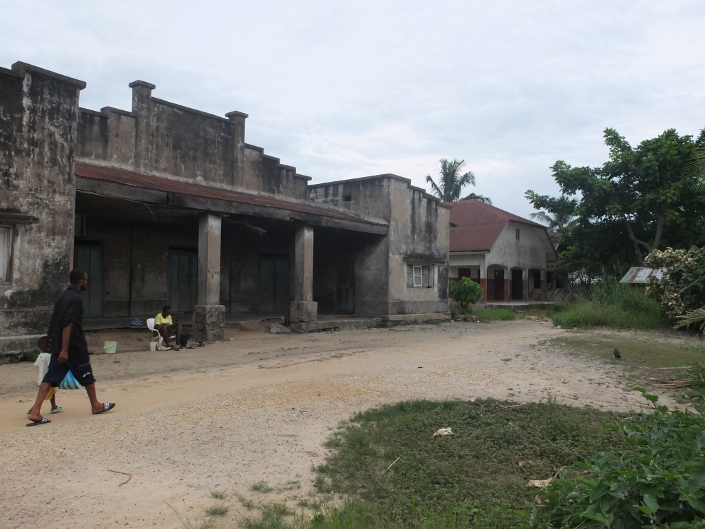
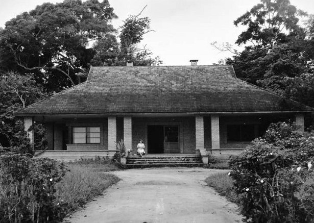
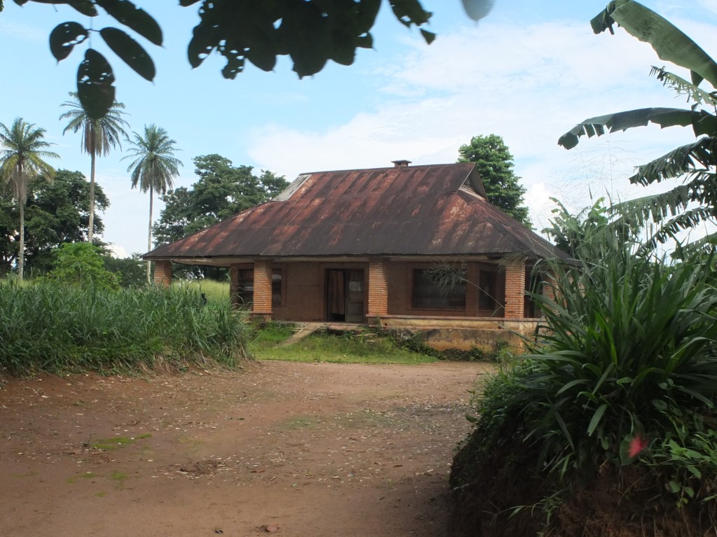
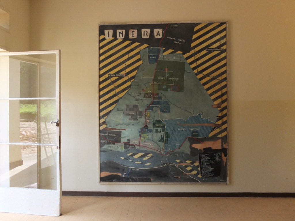
Yangambi — Sitting on the backseat of a motorbike running on a rutted dirt road, the lacking comfort is compensated by the view of riverine villages plunged in the luxuriant vegetation and by the glimpses of open horizon on the Congo river. When approaching the Yangambi reserve, the red brick walls of large villas appears on the side of the road, half concealed by the foliage of large ferns. The 250 villas built between 1933 and 1960 scattered across the reserve once housed the scientists and technicians of what was one of the largest ecological, biological, and agricultural research hubs in Africa, the >>Institut National pour les Etudes Agronomiques du Congo Belge – INEAC, later renamed INERA. The derelict storage tanks and the broken windows of the two large buildings facing the river port are the first visible signs of the now partly lost thriving life of this centre. But some sections of the research hub are >>still active.
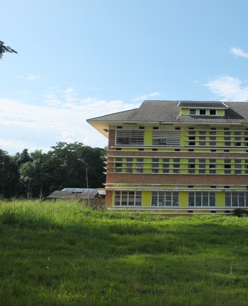
During the few days I spend in Yangambi, Dorcas drive me from one section to the other of the reserve The library, inside the recently restored administrative building, has a large collection of magazines and publications dating back both to the colonial and Mobuto’s regimes as well as reports and correspondence documenting the exchanges that the institution had established with private companies such as the Huileries du Congo Belge and Lever Brothers. Even today, the centre carries out agronomic research and provide the germinated seeds of oil palm trees to smaller and larger >> Elaeis plantations in the country. The number of houses, communal facilites, and buildings dedicated to the different research sectors that I could brielfy see from the car or from the photographic albums stored in the library would definetely deserve to be explored with more attention but I’ve run out of time. The boat is waiting.
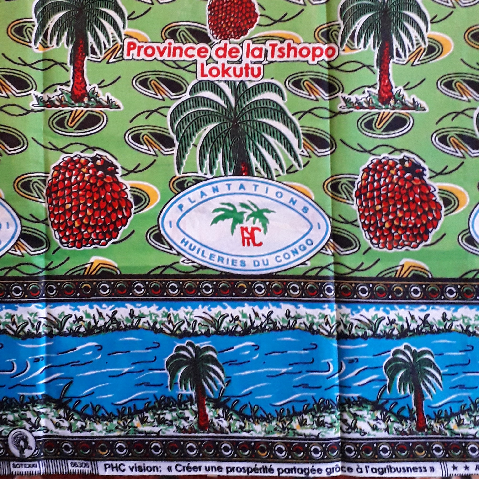
Kisangani — I’m already on the way back to Kinshasa when, during a two days stop in Kisangani that allows for a quick visit to the city, I find a piece of wax print fabric depicting the destination of my next trip to the DRC. In a small shop, one of the last selling locally produced Congolese wax fabric, among the most bizarelly decorated pieces of cloths, one is dedicated to the >>Plantation et Huileries du Congo, the company owning three of the former HCB plantation. Over a green background, the same palm tree and red oil palm bunch is repeated over and over. At the bottom, a sketched and colourful representation of the Congo River and its green banks along with some particularly >>optimistic mottoes of the company.
I greet the country carrying with me this small trace of the persisting signs of British-Belgian colonial capitalism in Congo. Lokutu (Elisabetha), Bumba (Alberta), and Lusanga (Leverville), three of the five company towns built by the Huileries du Congo Belge will be the subject of my next fieldwork in the coming months.
Eager to secure the provision of raw materials at low cost to its flourishing soap factories in Liverpool, Lever Brothers and the United Africa Company (UAC) acquired land concessions from colonial states across the oil palm belt in West Africa. Beginning from the early 1910s, subsidiaries such as the Huilieries du Congo Belge (HCB, later Huilever and Plantations du Congo), and Pamol, established oil palm plantations in today’s DR Congo, Congo-Brazzaville, Nigeria, Ghana and Sierra Leone.
Plantation workers holding a bunch of fruit of Elaeis Guineensis (African oil palm). Oil is derived from fruit’s outer layer and cracked kernel. The photo was taken near the Alberta plantation in the Belgian Congo, probably in the 1930s or 1940s.Agronomists selected oil palm varieties to maximise the quantity of oil and facilitate the cracking of the kernels.Plan of a plantation on the Benin river in Nigeria showing the subdivision of the planted area in square sectors; the location of the oil mill and wharfs where palm oil was extracted and loaded on boats; and the area where worker houses were built.
Historians such as Jules Marchal lengthily detailed the brutality of Lever Brother’s exploitation especially in the Belgian Congo, the forced resettlement of local population, and the violent repression of “uncooperative workers”. However, this attitude uneasily coexisted with a paternalistic, but probably genuine, hope that plantations would bring “progress and civilisation”. Such hope – Benoit Henriet argues – was compromised by the overriding need to turn a profit but it requires to be analysed beyond oversimplifying narratives of predatory capitalism.
Our initial exploration of the rich UAC archival collection revealed that plantations had been the locus of a wide array of experiments combining agronomic knowledge with political, economic, social, and cultural tools. The plans and photos of worker houses and communal facilities, and the numerous written exchanges on the social aspects of work organisation and the daily life of workers in the plantation shows that architecture played a relevant role in giving tangible form to the company’s largely unfulfilled ambitions to widespread social development.
Diorama showing two HCB oil palm plantations presented at the Ghent Universal and International Exhibition in 1913.“Model houses” for workers in the Brabanta plantation, Belgian Congo.Native dwelling quarters in an unidentified Huilever plantation.Views of worker houses and public facilities in Leverville, Belgian Congo.
While the construction of villages for plantation workers such as Leverville offers the occasion for a critical reflection on the role of architecture in private colonial exploitation, other documents from the UAC archives suggest that plantations had been the testing ground for innovative spatial planning models. Indeed, over the course of the 20th century, changes in plantation management and spatial structure overlapped with the evolution of ideas on social engineering and rural development.
In the 1930s and 1940s for example – as Jonathan Robins highlights – in response to the well grounded critiques on the social and environmental sustainability of plantations in West Africa, UAC proposed plans for a reformulation of plantation organisational system. The model they proposed would later influence policy recommendations given by international organisations such as the World Bank to developing countries across the globe. The experimental plantation model, the Nucleus Estate-Smallholder (NES) model, claimed to combine the virtues of the plantation system of management with the “social attractions” of peasant agriculture. This farming system entailed a spatial structure in which a nucleus, composed of a plantation established on a land concession and managed by UAC, is surrounded by further plantation sectors operated by smallholders.
The extent to which this and other models were successful in improving the living condition of local farmers or rather were functional smokescreens for the perpetuation of colonial or neo-colonial extractivism remains an highly debated topic. Certainly, plantations remains, both at the architectural and territorial scale, a fascinating subject which we will continue to explore in the following months and an opportunity to explore the multiple intersections between development ideologies, colonial and post colonial histories, and architectural and planning knowledges.
–
Henriet, B. (2021) Colonial impotence: virtue and violence in a Congolese Concession (1911-1940), De Gruyter Oldenburg.
Robins, J.E. (2021) Oil palm: a global history, University of North Carolina Press.
Marchal, J. (2008) Lord Leverhulme’s ghosts, Verso. First published in French as (2001) Travail force’ pour l’huile de palme de Lord Leverhulme: l’histoire du Congo 1910-1945, vol.3, Paula Bellings.