Archive

Tag Archives: Market

Central Market Rabat. Source: Postcard, 1925 (Author’s collection).

Rim Yassine Kassab writes:

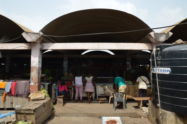
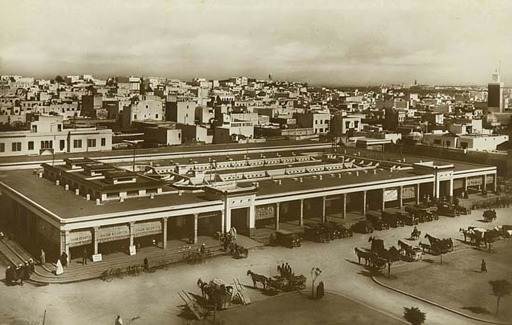
In 1925, the Central Market of Rabat was built at the outskirt of the medina (the old city) by French Colonial powers (1912-1956). Despite being the only element displayed in colonial maps of the medina, and one of Rabat’s current landmarks, the history of the market is still unknown. Drawing on the National Moroccan archives and on colonial postcards, the article explores the historical and urban significance of the Central Market for Rabat colonial and postcolonial history. It argues that the market constitutes a unique architectural and urban case for Rabat as it both challenged and reinforced the colonial agenda. Planning principles like the policy of association, the ‘image of the city’ and the ‘dual city’ were not only defied by the market, but also by the demolition of the part of the wall in front of it. This revealed the inconsistencies and lack of homogeneity of the colonial approach. Moreover, without the wall, the medina became penetrable by the ‘Ville Nouvelle‘ (New Town). Engaging with the Central Market is significant for the history of colonial planning, but also for today’s Rabat identity construction, inscribed in 2012 in the UNESCO World Heritage Sites and elected cultural capital in 2022.

Read the full article in Planning Perspectives , Open Access: https://www.tandfonline.com/doi/full/10.1080/02665433.2022.2130964

Notes from Tema, Ghana

We visited Tema, the new port and town built 10km east of Accra in the 1950s and early 1960s. Planned as part of a suite of infrastructure projects including, an aluminium smelter, docklands, and hydroelectric dam, the town was to provide model housing in a series of self-contained neighbourhoods, called ‘Communities’. Each has its own central market area and Community Building surrounded by a series of residential areas. The houses are set around schools and recreation areas, and grouped according to size and occupant income.

We began at Community 1 and explored the market area, complete with extended community centre, before finding some of the distinctive ‘Type iv’ housing. The housing has been extended and in-filled but the original basic form is just about discernable. Other housing had been supplemented by gardens and painted facades. The low-rise flats with central access staircase have been well-maintained and there is a strong sense of pride in the neighbourhood here.

Michael Hirst designed the Type iv housing. He studied at the Architectural Association in the Department of Tropical Architecture before moving out to Ghana (then known as Gold Coast) in the mid 1950s. He worked for the Tema Development Corporation, and lived in the Denys Lasdun designed flats in Tema. We had a good look for these flats and hoped to track them down – but alas, they eluded us….

Community 2 Housing

Community 2 Housing

At Community 2 we saw some grander properties (surely inspired by Maxwell Fry’s work in Chandigarh), as well as a market with vaulted roof and carefully detailed concrete and guttering system. The structure is, however, badly corroded and in need of urgent repair. The traders informed us that the market is likely to be demolished and replaced shortly.

Community 2 Market

We moved on to Tema Manhean, the ‘replacement fishing village’ built to house the Ga People who were displaced with the building of Tema (see our paper for more detail). The settlement wraps around the light house and is made up of a series of compound houses designed by Maxwell Fry and Jane Drew. We found one compound that was built in 1961 (as noted by the date etched into the concrete during construction) and barely modified since. It was a perfect example of just how successful and adaptable the compound typology can be.


SaveSave

In between improvisation, compensation and negotiation: a socio-spatial analysis of Kariakoo market (Dar es Salaam) dynamics under British colonial rule (1919–1961), by L Beekmans and J. R. Brennan, published in History of Retailing and Consumption, vol2, issue 1, 2016.

Abstract.

“This article examines the socio-spatial history of the central market of a colonial African city. Colonial policies of racial segregation created obstacles to commerce, which in turn generated a local strategy of improvisational planning to placate various urban actors with a host of often contradictory concessions to ameliorate dislocation. These contradictions of colonial governance played out most visibly in the struggles over Kariakoo market, which became the city’s primary market after its construction in 1923.

DSCF1230

Kariakoo Market, March 2016

By focusing on contests over the spatial ordering of commerce and residence in a multi-racial city ruled by Europeans, commercially dominated by Indians but overwhelmingly populated by Africans, this article demonstrates how the production of certain types of urban space creates unforeseen leverage for local actors, which simultaneously entrenches wider patterns of obstinate racialization despite the ubiquity of planning concessions. Using deeply researched archival evidence as well as a rich secondary literature, the authors argue that the city market best illustrates the racially contradictory impact of the colonial state on an urban landscape.”

Full article available here: http://www.tandfonline.com/eprint/vGx4RCbCui3cBncBNP8h/full 

TAG also included recent posts on Dar es Salam here: A quick tour of Dar es Salam and here: Urban Narratives (Simulizi Mijini) Symposium Report