Archive

Tag Archives: Ghana

“Founded in 1922, Deo Gratias is the oldest photography studio still in operation in Accra. As the city celebrates 60 years of independence this week, the studio has revealed new photos of life in the 1920s and 1930s”.

Does Achimota School still have such a formidable boxing club?

2464

9789

Empire Day, Accra, 1930

More photos here: https://www.theguardian.com/cities/gallery/2017/mar/07/accra-a-century-ago-ghana-before-independence-in-pictures

Lou Moon:   Viewing tropical materials, renewable technologies and local community engagement at a coastal resort.  

Ola Uduku Writes:

Climate responsive, tropical architecture using locally sourced materials remains a rarity in West Africa, therefore setting foot at the remote coastal Lou Moon resort was a revelation. At first glance this seemed like yet another ‘safari-architecture’ beach resort on the Ghanaian coastline [20 minutes drive from Axim]. The first view of a dining area with non-local thatch roofing initially suggesting a copy of an aesthetically pleasing safari ‘hang out’ for expatriates and daring local tourists willing to get to this off-the-beaten-track location.

img_0710

“Are we nearly there yet?” The track to Lou Moon

On closer inspection and conversation with Lou Moon’s designer and owner Paul Ramlot, it was explained to us that the roofing is not indigenous to Ghana’s coastal communities but was indeed an import from the middle to northern part of Ghana. He had worked with northern Ghanaian thatchers and local craftsmen to ensure the construction of a watertight roof covering. He explained that this had been achieved successfully, and the only problems that had been encountered since it had been completed were with with local bats and grass cutters, that from time to time nest and forage in the thatch. Catching them was tricky  – but sonic deterrents were now being successfully used.

img_0719

Architect and owner of Lou Moon, Paul Ramlot with Ola Uduku

After a good lunch from an impressive menu boasting  European – Ghanaian ‘gastro’ cuisine and the option of good French wine (which we declined) we were shown more of the resort. The owner had worked hard to tame the land jutting out to the sea and create a number of secluded chalets, using locally sourced building materials and oriented to allow local ventilation and lighting. Whilst specialist bath fittings were imported, 90 % of the materials were sourced locally and the owner worked  with local craftsmen to develop the accommodation at the resort. This was a textbook demonstration on what is possible but has rarely been achieved in contemporary West Africa.

By working with local craftsmen, and employing local staff at the resort he had also both given employment opportunities in a part of Ghana where there are few such opportunities available. He also had a working arrangement with the ‘chief’ and ultimate owner of the land on which the Lou Moon Resort has been built. A share of the profits is paid to the chief and his community.

Resort chalets had solar photovoltaics incorporated into their design, and wireless communication, and electricity were freely available along with a large satellite dish in clear view. Interestingly on arrival we noted a number of vehicles with diplomatic number plates, possibly the remoteness of the location had in the past made it the perfect retreat, one wonders whether this remains so appealing, now that it is hooked up to the world via its telecommunications systems. Judging by the resident clientele at the resort in the January off peak season this didn’t seem to be the case.

We left musing that it took a Belgian expatriate to rediscover local materials and encourage local design talent in this remote part of Ghana. His design model had been so successful that he was in conversation with local elites to develop a similar resort on private land to reap these benefits. What was his most serious problem we asked him? He responded that it was the noise from the local community at funerals and other festivals…

We hope that a cordial arrangement can be agreed to secure the serenity of this snapshot of tropical architectural paradise. We made ‘design attribution’ peace with the non-local indigenous thatch roofing, we saw no vermin, enjoyed the shade and couldn’t fault its aesthetic contribution to what had been a truly revealing ‘Lou Moon’ experience.

Adjena Revisited

Ola Uduku writes;

It was a long and dusty journey, we soon understood why the taxi wouldn’t haggle down from the amount he quoted. The road definitely existed, it was just in very poor condition and work was being done near the end of the journey to Adjena to re-grade the laterite. We finally pulled into a gathering of housing on each side and slowed down, I said this looks likes ‘tropical designed housing’.

dsc_0456

A hand-operated water pump caught our eyes and we watched a small gathering of  women and children pump up their water into buckets and containers and then take them away for use.  We walked to two elderly men dozing under a tree and asked the throng if we could wake one up.

img_0727

‘Is the Adjena resettlement area?’, we asked.

‘yes’ came the reply.

Our first informant was in his eighties and  had arrived when the first set of resettled villagers were moved to the site in 1957. He explained that there was a school further along and more housing.

We went further into the clearing and hit gold – a small school designed around a courtyard to specific tropical standards. Windows were deep and allowed light to penetrate through the classrooms, and the verandas were ample to enable their use in teaching.  The school was foregrounded by a number of trees which seem to have been planted to a specific format, unfortunately they seemed to be dying, but they still helped frame the school and looked as if they were very much part of the school grounds.

dsc_0439

Moving on from the school we came to a clearing with a designed kitchen–cooking area central to a number of small dwellings. We stopped and talked to Agnes, whom we asked about what she remembered about moving to Adjena. She immediately recounted that she had been 27 when the move had taken place and she was 87 now. A quick date check confirmed that these dates tallied with the move of the settlement in the Volta valley to Adjena. As we chatted with her on the step to the kitchen she explained that she preferred the new settlement to the old as the new buildings were  ‘Cortex’, the name given to the company who built the settlement made up a concrete frame with infill breeze block walls.

dsc_0443

We passed a number of small dwellings designed as part of the scheme. All dwellings now had electricity with television sets to prove it, however water was only available via the standpipes that we had seen when we walked into the settlement. The communal WCs did not seem to well used, one supposes that in this very remote rural area this option was unlikely to be popular.

For a resettlement scheme approaching its 6th decade Adjena was in good condition, it now had a junior secondary school and the road carried both the electricity lines and also the mobile phone masts. The road also ran through to the community council offices and there were other settlements which were now part of the greater extended Adjena community.

Developments were coming to Adjena, and we had been made welcome guests to this sleepy, yet thriving community. What would Leo De Syllas and the other designers of the then New Adjena think of their creation more than half a century on? An understated success we’d say as we made our dusty way back to the town.


Field Work: Axim and Dixcove

Heading west from Takoradi along the coast-road towards Côte d’Ivoire there are a number of fishing towns and natural harbours, such as Axim and Dixcote.

img_0697

Dixcove Harbour

IMG_0692.jpg

Fishing Boats at Dixcove

Axim was a major port during the early 20thC, exporting £250,000 worth of goods in 1913, and the mail boat from Liverpool (as well as ships from the US, Germany and Belgium) called every 10-15 days before heading on to Sekondi. Before the British occupied the Fort at Axim (Fort St. Anthony) it was held built by the Portuguese in 1515 and then captured by the Dutch from 1642. The Fort was conceded to Britain, along with the other Dutch forts east of Elmina on the 6th April 1872.

A European hospital was established in the town in 1901, and the British Bank of West Africa opened a branch, having traded in Accra from 1897. There are still some colonial buildings to be found, and a photograph of the District Commissioner’s bungalow (c.1914) is held in the UK National Archives.

axim-bungalow

Type B Public Works Department Bungalow in Axim

Besides the Fort, the Quandahor Building dominates the town from its elevated position. The building (according to some sources) was built in the 1920s, but with what purpose and by whom?

dsc_0426

Quandahor Building in Axim

Nearby Dixcove also has its fort (macabrely named Fort Metal Cross after the slave branding iron used there) and the town still retains its thriving fishing industry. The fortress was constructed from 1683 by the Royal African Company and continues to resemble the 1806 print below. Needless to say, it is a harrowing structure, and a surviving relic of what must be one of the lowest points of British history.  By 1868 the Fort was under Dutch control, before being returned to the British just four years later. It was made a World Heritage Site in 1979 and has recently been inhabited by an Englishman intent on refurbishing the place.

phpthumb_generated_thumbnailjpg-2

1806 Print depicting Dixcove

DSC_0414.jpg

Dixcove Fortress

It was only in 1911 that a Customs Warehouse was completed and a market shed was erected in the Dixcove – is the image below the customs warehouse? A few other Colonial period buildings survive and we will endeavour to find out more about this fascinating place.

dsc_0423

The Customs Warehouse in Dixcove?

An Update from Takoradi, Ghana Part 2

The docks and rail infrastructure of Takoradi was the impetus behind its rapid expansion from a small village to a major town. Construction commenced after WW1, but before this took place, it was neighbouring Sekondi that dominated the area with its grand houses, trading offices and the plush Metropole Hotel. The Dutch established Fort Orange there from 1670 and the natural harbour provided a suitable place for light vessels to shelter whilst the surf boats manned by the Kru people brought goods and people ashore.

evernote-snapshot-20160720-121210-copy

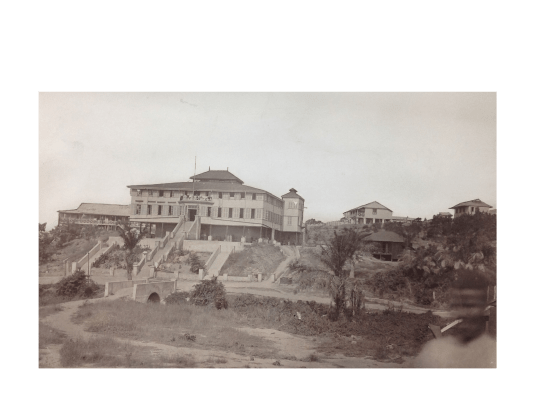
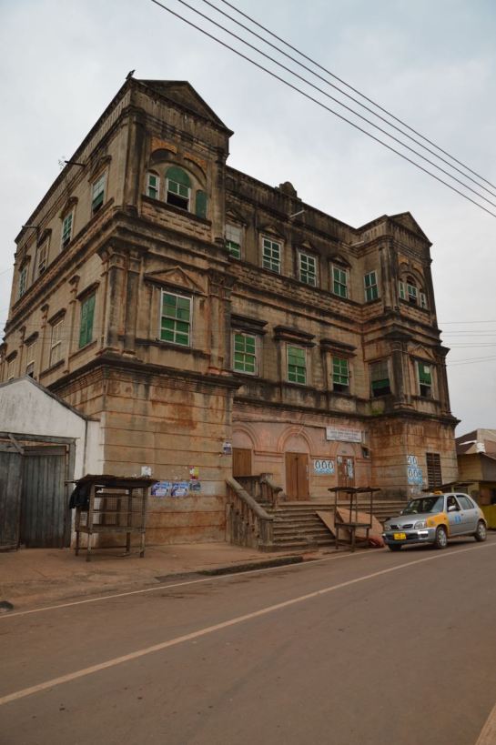
The Metropole Hotel, Sekondi

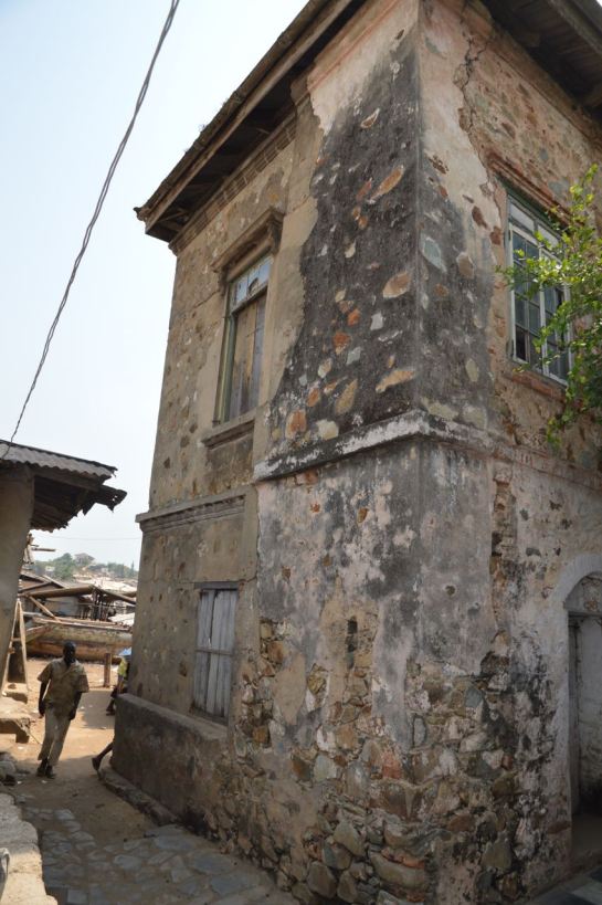
There is some rich architectural heritage in this town, and clear evidence of a once prospering settlement full of traders and merchants. Those days are clearly gone.

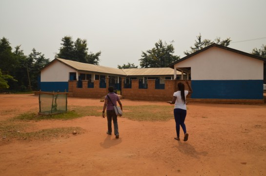
We started with two schools, the first called Fijai, captured here by the UK National Archives Africa through a lens. Then onto St. John’s, again the vintage photo below shows the clean lines of the school, when constructed c. 1955.


dsc_0383

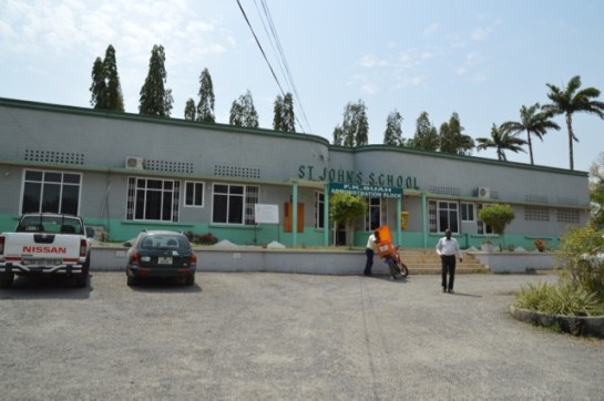
St. John’s School, Sekondi

There have been further additions to the school including the striking church, donated by a Wisconsin family , with its large A-line structural frame,  finely detailed concrete casting, wooden ceiling and pre-cast screening. Next to St. John’s is Adiembra housing estate. There were revisions proposed for Adiembra in the 1944 Town Planning report made by Maxwell Fry and Jane Drew, but it is difficult to ascertain what impact this report made on the area, if any. However, we did spot some standpipes and washing stations that resemble those proposed by Fry and Drew in their manual, Village Housing in the Tropics, so perhaps this is evidence of their involvement.

dsc_0376

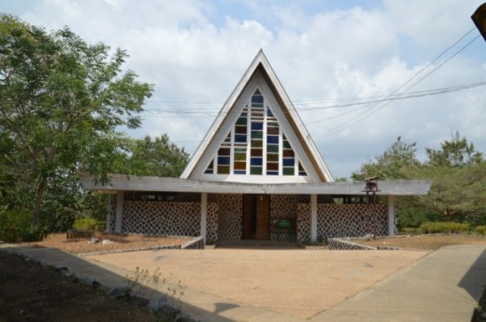
The Church at St. John’s School

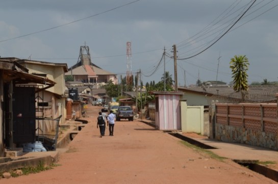
We went onto the main street of Sekondi where the Post Office is located. We discussed this building in our chapter in Bremner’s Architecture and Urbanism in the British Empire, but were now shocked to see how the exquisite timber counter had been painted in bright blue gloss – destroying the previous display of tropical hardwoods. The rest of the street has only gotten worse since our last visit, with many of the former colonial buildings on the brink of collapse. Absent landlords coupled with a shrinking economy has left these structures vulnerable and economically unviable. Further sad news must be reported, as the modernist Sekondi Regional Library has recently been demolished and replaced with a new library.

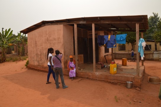
Our final visit in Sekondi was to the coastal-road village of Ekuasie, laid out in 1912. This was an early attempt at providing worker housing and adopts the familiar grid iron street format, although far more loosely imposed than similar schemes elsewhere (such as Korle Gono). There are some later and grander additions to this village, including a set of houses from the mid 1950s.

img_0663

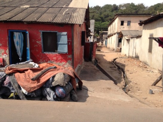
Ekuasie Housing Estate

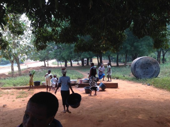
We returned to Takoradi and explored the workers’ estate, mentioned in the PRAAD archives as the ‘labourers housing and school’ at the Zongo area. This is still a thriving area, Hausa was heard being spoken and the tiny streets eventually lead to a playground-cum-village square, overlooked by the Islamic school and Mosque.

cimg5294

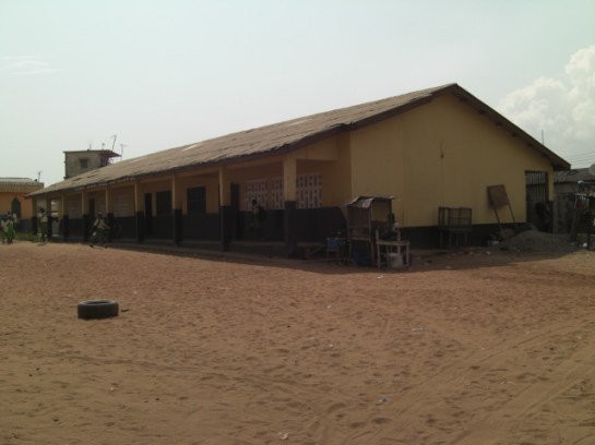
Takoradi Zongo School

An Update from Takoradi, Ghana

We started at the Takoradi Train Station, completed by 1928 as part of the coastal rail and docklands development. The train lines were initially constructed to transport cash crops, minerals and metals from the northern agricultural and mining districts to the awaiting ships, sheltered in the newly constructed breakwater and deep water harbour. When we visited in 2012 the train station was completely derelict and not in use. Today we found it carefully restored and new tracks laid. The plan is to reuse it for a local transport network. We walked up the hill to the small commercial district made up of international banks and a post and telegrams office. The mishmash of styles reveals the incremental development, as well as the fierce competition between the banks eager to differentiate themselves from the competition.

The former European hospital clock tower up on the hill overlooks the banks and docklands, as well as benefiting from the cooling sea breeze.

We drove to the 1920s part of Takoradi, a major new town extension that was built to accompany the docks development of that time. This portion of the town was primarily for the African population, although it also contains the Lasdun designed Bank of Ghana [built 1957]. Lasdun was also the architect of the National Museum in Accra. The bank was vacant when we visited in 2012, but now it stands in a state of complete dereliction, its fine materials and fixings being stripped from the building. This is a real tragedy. It was once an outstanding building, recorded in the Architecture journals of the day and surely one of Lasdun’s greatest works from this period.

img_0633

Somewhat downbeat, we bid farewell to the bank, and made our way to the rond-point in the middle of the town. The map was deceiving, as this was built as a major market place – our driver told us it was one of the largest markets in West Africa. It had the feel of Kariakoo market  in Dar es Salaam, and also contains a delightful little PWD post office with its signage graphics still intact.

Adjacent to the market is Amanful Village. Laid out in 1922-3 it is a mixed use area of housing and commercial properties. The basic PWD-type houses and layout remained in place, but more wealthy owners had transformed much of the upper part of the estate to suburban housing.

We then went to the Takoradi Technical Institute, shown above (Left, b+w) in the Africa Through a Lens Collection at the UK National Archives. There is a forcefulness to this scheme that takes the familiar two storey gallery access format, and emboldens into more ‘clunky’ yet determined architectural-structural forms.

dsc_0363

Nearby is the Effiekuma housing and the Effia Nkwanta hospital. The hospital has evolved overtime from a European hospital-cum-sanatorium in the colonial period, to a major health provider today. The careful layering and response to the site contours offers delightful views as well as a most welcome breeze to all the small structures that each have a view of the docks. At the top of the hill is a large brutalist extension that dates from c. late 1960s early 1970s. But who designed it?

As part of our British Academy Internationalisation and Mobility grant Iain Jackson and Ola Uduku visited Rexford Opong at KNUST in March (we included some brief updates here: Notes from Kumasi and Notes from Kumasi: part 2 and also Notes from Kumasi Part 3). We were fortunate enough to visit the Estate Planning Department and drawing offices and photographed some of the original drawings made of the university estate and buildings. Whilst every effort is being made to carefully preserve these drawings they have been subject to the ravages of time, humidity and vermin attack and many are in a poor state of repair. They are unlikely to survive for much longer.

dsc_0170

Drawing of the First Floor Senior Staff Club House, KNUST

In an attempt to remedy and counter this we are putting together an ‘Archives in Danger’ grant that, if successful, will enable these important artefacts to be digitally scanned/carefully photographed and then carefully preserved and archived for future scholarship.

In the meantime we’ve used the photographed drawings to produce a series of new CAD files. Pedro Bittencourt, a student based at Liverpool School of Architecture, has worked dilligently on translating the imperial scales into a metric format and has produced all of the new drawings. He has then used these drawings to construct a beautiful scale model of the Club House, utilising a laser cutter as to form the delicate components.

pedro

Pedro with the completed scale model

We’re hoping to produce additional models of other buildings on campus that can be used in exhibitions and as part of our lecture series.

img_0125img_0126

2016 Grantees for Conserving Modern Architecture Initiative Announced

TAG is delighted that the Getty Foundation has awarded a ‘Keeping it Modern’ heritage grant to the Children’s Library in Accra, Ghana – the first time this prestigious award has been made to a building in Africa. This will fund building research into the material fabric of the library, as well as programme of events to keep the space activated and enjoyed.

The library was designed by Nickson and Borys (see Notes from Accra ) in late 1950s / early 1960s (the building appears in J. M. Richard’s New Buildings of the Commonwealth, 1961) and has already received some sympathetic restoration in more recent times, as well as some less fortunate interventions (such as the aluminium front door).

The latest project will be in safe hands under the leadership of the ArkiAfrica team, http://archiafrika.org/wp-content/uploads/2013/03/march-13-invite.jpg  and we will post updates on the project here.

Getty press release and information on the other awards here: http://blogs.getty.edu/iris/2016-grantees-for-conserving-modern-architecture-initiative-announced/


Good bye Kumasi, Accra, Ghana….

We revisited the Manhyia Palace archives and made notes on the relevant documents to be consulted before dashing off to board the local propeller plane back to Accra. Gazing at the dusty spread of Kumasi – we wondered whether the current airport terminal was adjacent to the original Norman and Dawburn small airport project designed in the 1950s? Suggestions of an earlier architectural history seemed to be revealed in the present day profiles of the domestic airport buildings viewed as we taxied down the empty runway for takeoff.

IMG_0144

‘Tropical Modernism’ on the 10GHC note, The Bank of Ghana in Accra

Accra was in the grips of a major traffic jam, cooler and drier than Kumasi, it proved overbearingly hot to spend more than half an hour getting from the airport to Jamestown to see the exhibition of the Delft-Accra, urban transformation collaboration project we visited on our arrival in Ghana. We met a transformed space and were given a tour by curator and ArchiAfrika member Joe Addo. Joe also spoke of his further plans for the activation of various parts of the Jamestown neighbourhood. A further visit to the National Museum offices, and another slow trip on Accra’s congested highway to the international airport concluded the trip, with Ghana’s independence day holidays over the weekend we weren’t the only ones heading out of town.

Our project continues; the Ghanaian team (Prof. Rexford Assasie Oppong and Irene Appeaning Addo) will begin planning their research trip to the UK in the autumn, and we have considerable sources to continue consulting in the meantime.


Notes from Accra Part 2

Our journey continued with visits to Tessano ‘East’ which had a few remnants of the original site and service planned estate, best exemplified by the police station and a few administrative blocks, which often defined the colonial housing plan layout. A visit to the University of Ghana, at Legon followed. Designed in the late 1940s by Harrison Barnes and Hubbard, the leafy campus sits upon on a hill, high above Central Accra. The campus architecture has a curious oriental aesthetic which defines the its identity, with a number of significant buildings including the Balme Library and the Main Hall. In the African Studies department we joined our British Academy project associate, Dr Irene Appeaning Addo, for a very productive meeting.

DSC_0905

Tisano East Police Quarters


DSC_0917

The Grand Hall and Tower at Legon University, Accra

A trip to the Korle Gonno Housing Estate followed, using then new drained highway over the Korle Bu inlet and past the University of Ghana Hospital. The Korle Gonno Estate demonstrated a very early example of decant housing as from conversations with an older resident of the estate it was found out that many of the original residents had been moved from the Jamestown area of Accra to Korle Gonnu, a few miles down the coast. The estate was more intact than Tessano, with a number of the original buildings still evident.

DSC_0928

Korle Gono Housing Estate: regulated street patterns and services

Korle-gono

Korle-Gono Model, c.1920? Photograph held in the National Archives, Kew, UK.

A walk around the “Ringway” estate ,where we resided took us to the “Osu” layout and a road which had a pair of suspected James Cubitt-designed residences . A second visit just before departure from Accra confirmed this, although their external facades had been significantly altered. The pair of residences are now in use by the diplomatic corps.