Archive

Tag Archives: hospital

Field Work: Axim and Dixcove

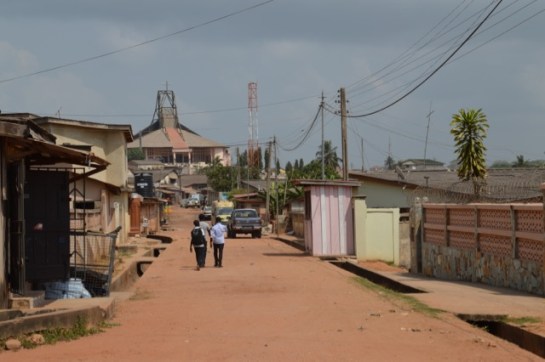
Heading west from Takoradi along the coast-road towards Côte d’Ivoire there are a number of fishing towns and natural harbours, such as Axim and Dixcote.

img_0697

Dixcove Harbour

IMG_0692.jpg

Fishing Boats at Dixcove

Axim was a major port during the early 20thC, exporting £250,000 worth of goods in 1913, and the mail boat from Liverpool (as well as ships from the US, Germany and Belgium) called every 10-15 days before heading on to Sekondi. Before the British occupied the Fort at Axim (Fort St. Anthony) it was held built by the Portuguese in 1515 and then captured by the Dutch from 1642. The Fort was conceded to Britain, along with the other Dutch forts east of Elmina on the 6th April 1872.

A European hospital was established in the town in 1901, and the British Bank of West Africa opened a branch, having traded in Accra from 1897. There are still some colonial buildings to be found, and a photograph of the District Commissioner’s bungalow (c.1914) is held in the UK National Archives.

axim-bungalow

Type B Public Works Department Bungalow in Axim

Besides the Fort, the Quandahor Building dominates the town from its elevated position. The building (according to some sources) was built in the 1920s, but with what purpose and by whom?

dsc_0426

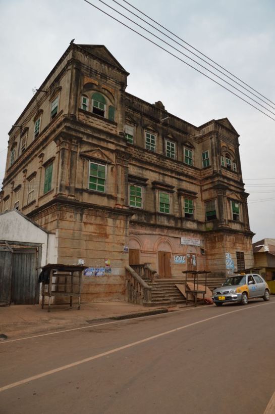
Quandahor Building in Axim

Nearby Dixcove also has its fort (macabrely named Fort Metal Cross after the slave branding iron used there) and the town still retains its thriving fishing industry. The fortress was constructed from 1683 by the Royal African Company and continues to resemble the 1806 print below. Needless to say, it is a harrowing structure, and a surviving relic of what must be one of the lowest points of British history.  By 1868 the Fort was under Dutch control, before being returned to the British just four years later. It was made a World Heritage Site in 1979 and has recently been inhabited by an Englishman intent on refurbishing the place.

phpthumb_generated_thumbnailjpg-2

1806 Print depicting Dixcove

DSC_0414.jpg

Dixcove Fortress

It was only in 1911 that a Customs Warehouse was completed and a market shed was erected in the Dixcove – is the image below the customs warehouse? A few other Colonial period buildings survive and we will endeavour to find out more about this fascinating place.

dsc_0423

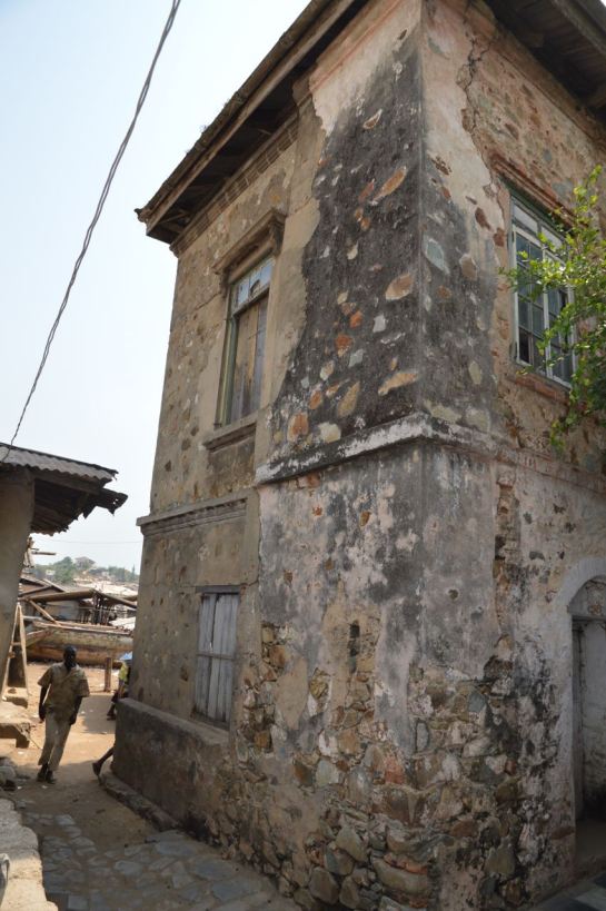
The Customs Warehouse in Dixcove?

An Update from Takoradi, Ghana

We started at the Takoradi Train Station, completed by 1928 as part of the coastal rail and docklands development. The train lines were initially constructed to transport cash crops, minerals and metals from the northern agricultural and mining districts to the awaiting ships, sheltered in the newly constructed breakwater and deep water harbour. When we visited in 2012 the train station was completely derelict and not in use. Today we found it carefully restored and new tracks laid. The plan is to reuse it for a local transport network. We walked up the hill to the small commercial district made up of international banks and a post and telegrams office. The mishmash of styles reveals the incremental development, as well as the fierce competition between the banks eager to differentiate themselves from the competition.

The former European hospital clock tower up on the hill overlooks the banks and docklands, as well as benefiting from the cooling sea breeze.

We drove to the 1920s part of Takoradi, a major new town extension that was built to accompany the docks development of that time. This portion of the town was primarily for the African population, although it also contains the Lasdun designed Bank of Ghana [built 1957]. Lasdun was also the architect of the National Museum in Accra. The bank was vacant when we visited in 2012, but now it stands in a state of complete dereliction, its fine materials and fixings being stripped from the building. This is a real tragedy. It was once an outstanding building, recorded in the Architecture journals of the day and surely one of Lasdun’s greatest works from this period.

img_0633

Somewhat downbeat, we bid farewell to the bank, and made our way to the rond-point in the middle of the town. The map was deceiving, as this was built as a major market place – our driver told us it was one of the largest markets in West Africa. It had the feel of Kariakoo market  in Dar es Salaam, and also contains a delightful little PWD post office with its signage graphics still intact.

Adjacent to the market is Amanful Village. Laid out in 1922-3 it is a mixed use area of housing and commercial properties. The basic PWD-type houses and layout remained in place, but more wealthy owners had transformed much of the upper part of the estate to suburban housing.

We then went to the Takoradi Technical Institute, shown above (Left, b+w) in the Africa Through a Lens Collection at the UK National Archives. There is a forcefulness to this scheme that takes the familiar two storey gallery access format, and emboldens into more ‘clunky’ yet determined architectural-structural forms.

dsc_0363

Nearby is the Effiekuma housing and the Effia Nkwanta hospital. The hospital has evolved overtime from a European hospital-cum-sanatorium in the colonial period, to a major health provider today. The careful layering and response to the site contours offers delightful views as well as a most welcome breeze to all the small structures that each have a view of the docks. At the top of the hill is a large brutalist extension that dates from c. late 1960s early 1970s. But who designed it?