Archive

Tropical Architecture

Lou Moon:   Viewing tropical materials, renewable technologies and local community engagement at a coastal resort.  

Ola Uduku Writes:

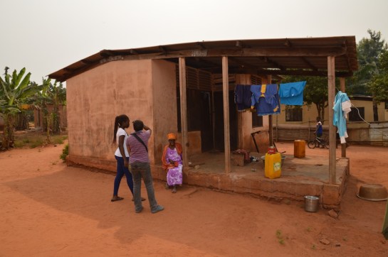
Climate responsive, tropical architecture using locally sourced materials remains a rarity in West Africa, therefore setting foot at the remote coastal Lou Moon resort was a revelation. At first glance this seemed like yet another ‘safari-architecture’ beach resort on the Ghanaian coastline [20 minutes drive from Axim]. The first view of a dining area with non-local thatch roofing initially suggesting a copy of an aesthetically pleasing safari ‘hang out’ for expatriates and daring local tourists willing to get to this off-the-beaten-track location.

img_0710

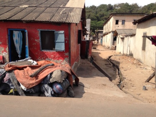
“Are we nearly there yet?” The track to Lou Moon

On closer inspection and conversation with Lou Moon’s designer and owner Paul Ramlot, it was explained to us that the roofing is not indigenous to Ghana’s coastal communities but was indeed an import from the middle to northern part of Ghana. He had worked with northern Ghanaian thatchers and local craftsmen to ensure the construction of a watertight roof covering. He explained that this had been achieved successfully, and the only problems that had been encountered since it had been completed were with with local bats and grass cutters, that from time to time nest and forage in the thatch. Catching them was tricky  – but sonic deterrents were now being successfully used.

img_0719

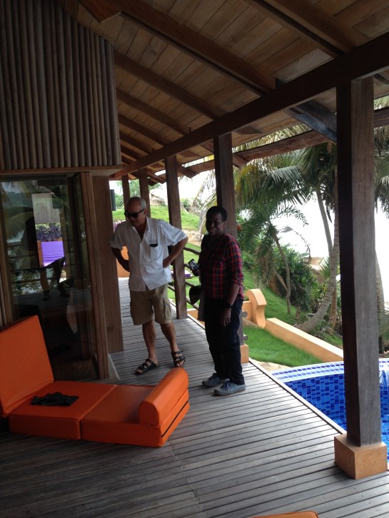
Architect and owner of Lou Moon, Paul Ramlot with Ola Uduku

After a good lunch from an impressive menu boasting  European – Ghanaian ‘gastro’ cuisine and the option of good French wine (which we declined) we were shown more of the resort. The owner had worked hard to tame the land jutting out to the sea and create a number of secluded chalets, using locally sourced building materials and oriented to allow local ventilation and lighting. Whilst specialist bath fittings were imported, 90 % of the materials were sourced locally and the owner worked  with local craftsmen to develop the accommodation at the resort. This was a textbook demonstration on what is possible but has rarely been achieved in contemporary West Africa.

By working with local craftsmen, and employing local staff at the resort he had also both given employment opportunities in a part of Ghana where there are few such opportunities available. He also had a working arrangement with the ‘chief’ and ultimate owner of the land on which the Lou Moon Resort has been built. A share of the profits is paid to the chief and his community.

Resort chalets had solar photovoltaics incorporated into their design, and wireless communication, and electricity were freely available along with a large satellite dish in clear view. Interestingly on arrival we noted a number of vehicles with diplomatic number plates, possibly the remoteness of the location had in the past made it the perfect retreat, one wonders whether this remains so appealing, now that it is hooked up to the world via its telecommunications systems. Judging by the resident clientele at the resort in the January off peak season this didn’t seem to be the case.

We left musing that it took a Belgian expatriate to rediscover local materials and encourage local design talent in this remote part of Ghana. His design model had been so successful that he was in conversation with local elites to develop a similar resort on private land to reap these benefits. What was his most serious problem we asked him? He responded that it was the noise from the local community at funerals and other festivals…

We hope that a cordial arrangement can be agreed to secure the serenity of this snapshot of tropical architectural paradise. We made ‘design attribution’ peace with the non-local indigenous thatch roofing, we saw no vermin, enjoyed the shade and couldn’t fault its aesthetic contribution to what had been a truly revealing ‘Lou Moon’ experience.

timescape1

Testing the Timescape Bengaluru app at Kempegowda Tower in Lalbagh Park. Watch the video here

In November and December 2016 Rachel Lee and Anne-Katrin Fenk were in Bengaluru working on the augmented reality Timescape app that the Envisioning the Indian City team developed for Kolkata in 2015. Supported by Goethe Institut Bangalore (Max Mueller Bhavan) and MOD Institute, and partnered by Bygone Bangalore and Centre for Public History at Srishti, we spent five weeks looking through image collections, selecting locations, conducting interviews, geo-referencing photographs, writing entries and testing out and evolving the app in the city. We discussed our progress and the interim results at a public presentation at the Max Mueller Bhavan on 16 December.

ashoka-pillar

Real time transparency corrections at the Ashoka Pillar with Martin Winchester of Liverpool University

Timescape, a smartphone/tablet app, draws on the real, existing fabric of India’s cities, combining it with archival image material and historical data to communicate urban heritage through an immersive augmented reality experience. Using geolocation services and push notifications Timescape is a serendipitous tour guide, an armchair heritage portal, and an educational resource. Informative and easy to navigate, the AR app brings evocative, vintage photographs from museum collections, such as the British Library, online databases, like the Facebook group ‘Bygone Bangalore’, and family archives to India’s streets, living rooms and classrooms. Images of tangible heritage, such as buildings, are complemented by documents relating to intangible heritage, for example music recordings, poetry, and recipes. Timescape aims to become an innovative forum for recording, exchanging and remembering the evolving urban cultures of Indian cities across the subcontinent. Timescape will develop an infrastructure that enables people to upload their own historical photographic collections and stories.

avenue-road

Screenshots of the app taken while walking up Avenue Road

As Bengaluru continues growing at an unrelenting pace, the historical fabric of the built environment is increasingly threatened. When, for example, nineteenth century bungalows are demolished to clear space for office towers, places that contribute to the foundations of the city’s and its citizens’ sense of collective identity and public memory are destroyed. In Bengaluru we focused on a central area including Chickpete, the Fort, Jayanagar and MG Road, which is particularly threatened by redevelopment. Features on buildings, such as the Rice Memorial Church or Krishna Rao Pavilion, were augmented by cultural institutions like the Indian Institute of World Culture, monuments like the Ashoka Pillar or the statue of Maharaja Chamarajendra Wodeyar X, and legendary local cultural hubs such as MTR Tiffin Rooms, Vidyarthi Bhavan and Koshy’s. As well as historic images, textual descriptions accompany the points of interest and in some cases sound files were added. We would like to expand the app to include edited oral histories collected in the neighbourhoods. Some of the points of interest have been archived on the MOD blog.

map-copy

Google map showing chosen points of interest and a screenshot of the app showing geolocated images in map mode

The presentation at Max Mueller Bhavan began with Anne-Katrin Fenk giving an introduction to archiving and curating urban history. Rachel Lee followed with a report on how the time in Bangalore had been spent and what progress we had made on the app, then Kiran Natarajan of Bygone Bangalore talked about the need for the app through his rather amusing “shock therapy” presentation, and finally Avehi Menon from Centre for Public History discussed the importance of oral history and how it could be integrated into the app through sound files.

In 2017 the next step is to apply for funding to move up a level and be able to devote adequate time to the development of the content and technology. We have a great team in Bengaluru, Berlin and Liverpool who are very enthusiastic to take it further.

after-presentation

The Timescape Bengaluru team and friends celebrating in Indiranagar after the presentation at Max Mueller Bhavan. From left to right: Kiran Natarajan, Anne-Katrin Fenk, Avehi Menon, Katerina Valdivia Bruch, Vivek Jain, Cop Shiva and Rachel Lee

A short video of Anne-Katrin Fenk and Kiran Natarajan testing the app in Lalbagh Park is available on youtube.

Article in the Times of India from 20 December 2016.

Article in The Hindu from 10 January 2017.

img_0133-kopie

img_0060-kopie

Adjena Revisited

Ola Uduku writes;

It was a long and dusty journey, we soon understood why the taxi wouldn’t haggle down from the amount he quoted. The road definitely existed, it was just in very poor condition and work was being done near the end of the journey to Adjena to re-grade the laterite. We finally pulled into a gathering of housing on each side and slowed down, I said this looks likes ‘tropical designed housing’.

dsc_0456

A hand-operated water pump caught our eyes and we watched a small gathering of  women and children pump up their water into buckets and containers and then take them away for use.  We walked to two elderly men dozing under a tree and asked the throng if we could wake one up.

img_0727

‘Is the Adjena resettlement area?’, we asked.

‘yes’ came the reply.

Our first informant was in his eighties and  had arrived when the first set of resettled villagers were moved to the site in 1957. He explained that there was a school further along and more housing.

We went further into the clearing and hit gold – a small school designed around a courtyard to specific tropical standards. Windows were deep and allowed light to penetrate through the classrooms, and the verandas were ample to enable their use in teaching.  The school was foregrounded by a number of trees which seem to have been planted to a specific format, unfortunately they seemed to be dying, but they still helped frame the school and looked as if they were very much part of the school grounds.

dsc_0439

Moving on from the school we came to a clearing with a designed kitchen–cooking area central to a number of small dwellings. We stopped and talked to Agnes, whom we asked about what she remembered about moving to Adjena. She immediately recounted that she had been 27 when the move had taken place and she was 87 now. A quick date check confirmed that these dates tallied with the move of the settlement in the Volta valley to Adjena. As we chatted with her on the step to the kitchen she explained that she preferred the new settlement to the old as the new buildings were  ‘Cortex’, the name given to the company who built the settlement made up a concrete frame with infill breeze block walls.

dsc_0443

We passed a number of small dwellings designed as part of the scheme. All dwellings now had electricity with television sets to prove it, however water was only available via the standpipes that we had seen when we walked into the settlement. The communal WCs did not seem to well used, one supposes that in this very remote rural area this option was unlikely to be popular.

For a resettlement scheme approaching its 6th decade Adjena was in good condition, it now had a junior secondary school and the road carried both the electricity lines and also the mobile phone masts. The road also ran through to the community council offices and there were other settlements which were now part of the greater extended Adjena community.

Developments were coming to Adjena, and we had been made welcome guests to this sleepy, yet thriving community. What would Leo De Syllas and the other designers of the then New Adjena think of their creation more than half a century on? An understated success we’d say as we made our dusty way back to the town.


An Update from Takoradi, Ghana Part 2

The docks and rail infrastructure of Takoradi was the impetus behind its rapid expansion from a small village to a major town. Construction commenced after WW1, but before this took place, it was neighbouring Sekondi that dominated the area with its grand houses, trading offices and the plush Metropole Hotel. The Dutch established Fort Orange there from 1670 and the natural harbour provided a suitable place for light vessels to shelter whilst the surf boats manned by the Kru people brought goods and people ashore.

evernote-snapshot-20160720-121210-copy

The Metropole Hotel, Sekondi

There is some rich architectural heritage in this town, and clear evidence of a once prospering settlement full of traders and merchants. Those days are clearly gone.

We started with two schools, the first called Fijai, captured here by the UK National Archives Africa through a lens. Then onto St. John’s, again the vintage photo below shows the clean lines of the school, when constructed c. 1955.


dsc_0383

St. John’s School, Sekondi

There have been further additions to the school including the striking church, donated by a Wisconsin family , with its large A-line structural frame,  finely detailed concrete casting, wooden ceiling and pre-cast screening. Next to St. John’s is Adiembra housing estate. There were revisions proposed for Adiembra in the 1944 Town Planning report made by Maxwell Fry and Jane Drew, but it is difficult to ascertain what impact this report made on the area, if any. However, we did spot some standpipes and washing stations that resemble those proposed by Fry and Drew in their manual, Village Housing in the Tropics, so perhaps this is evidence of their involvement.

dsc_0376

The Church at St. John’s School

We went onto the main street of Sekondi where the Post Office is located. We discussed this building in our chapter in Bremner’s Architecture and Urbanism in the British Empire, but were now shocked to see how the exquisite timber counter had been painted in bright blue gloss – destroying the previous display of tropical hardwoods. The rest of the street has only gotten worse since our last visit, with many of the former colonial buildings on the brink of collapse. Absent landlords coupled with a shrinking economy has left these structures vulnerable and economically unviable. Further sad news must be reported, as the modernist Sekondi Regional Library has recently been demolished and replaced with a new library.

Our final visit in Sekondi was to the coastal-road village of Ekuasie, laid out in 1912. This was an early attempt at providing worker housing and adopts the familiar grid iron street format, although far more loosely imposed than similar schemes elsewhere (such as Korle Gono). There are some later and grander additions to this village, including a set of houses from the mid 1950s.

img_0663

Ekuasie Housing Estate

We returned to Takoradi and explored the workers’ estate, mentioned in the PRAAD archives as the ‘labourers housing and school’ at the Zongo area. This is still a thriving area, Hausa was heard being spoken and the tiny streets eventually lead to a playground-cum-village square, overlooked by the Islamic school and Mosque.

cimg5294

Takoradi Zongo School

24 hours in ‘downtown’ Nairobi

Dr. Ola Uduku, Dean of Africa, University of Edinburgh

Nairobi definitely has its charm. Unlike West Africa’s capital cities with their myriad of pot-holed or dirt tracks for roads, Nairobi’s roads at first glance seem akin to being in South or North Africa if not the West. The motorways seem to thrust the driver into the superhighways and traffic freedom that most of Africa can only dream of. Even the traffic lights work – in a peculiar manner we found out.

Image set 1: Downtown Nairobi

A trip from the airport to the city centre however can take 2 hours at peak traffic congestion periods or if it rains, so the absence of potholes does not equal speed of arrival. As one nears the city various parts of the skyline become more visible. An abstraction of the empire state building, followed by a squat version of Big Ben, signifying the parliament buildings, then the thrust of downtown Nairobi. The informal city seems well removed from view as the planned city is viewed before one’s eyes. Conference over, on day three a motley group of presentation weary conference attenders take a walk through central Nairobi – this is what we saw.

Starting out a vantage point on Kimathi Street we walked past the ‘hip’ Java Café to a bookshop in search of Iwateni and Wanjiku’s A Brief Tour of the Buildings of Nairobi, five-star recommendation if you can find it. I wanted to find Dorothy Hughes’ cathedral, which seemed absent from our Guidebook, we finally found a very short paragraph about it – clearly not significant to our guidebook writers. We nearly walked past its unimposing exterior façade.

Image set 2: Cathedral designed by Dorothy Hughes

Security in Nairobi has heightened since Westgate, so getting in to the building required bag searches and photography was not allowed. A discussion with the priest in charge gave us the permission we craved. Hughes’ oeuvre is definitely worth viewing. The play of light and the scale of the glazing enraptured us for the better part of half an hour. Its expressed structure also mimics well the stonework of the traditional European church in cast concrete ribs with occasional delicate details. Presumably planned to respond to the post Vatican Council 2 church layout, it has the alter moved from the apse to engage more with the congregation. This works well in relation to the cruciform structure of the layout.

Enroute we came across the memorial to Lionel Douglas Galton-Fenzi who was involved in an early car rally, which established road routes from Nairobi to various parts of East Africa and founded the East African Automobile Association. The monument also marks the historic central milestone for Nairobi Kenya, and gives distances to various faraway destinations. Not in terribly good shape but gives a sense of Nairobi in relation to the rest of the African continent.

Next stop KICC Centre. More security checks to get in to what, at first glance seemed, an inauspicious entrance to a rather large structure. As we make our way to the entrance however the structure begins to emerge. A very Scandinavian group of offices in a watered green setting soften’s the structure a brutalist concrete façade from ground level upwards to the scaling of a group of Swedish chalets. The entrance podium level is dark wood and retains its seventies interior design. The trace of a once clock strikes the right spot for the pre tower climb. The lift to the 27th floor works, and we get out before realising there is still some climbing to do. The top of the tower gives an amazing vantage point. A few other intrepid visitors share our view, Nairobi revealed, is a very green city but noisy too we can hear the soundspots and see the transport chaos from afar. Fast trip down and a coffee stop with a great view of the building – we didn’t make it into the conference centre but viewing the interior setting compensated for this. The detailing cries back to the Barbican Centre in London, apparently Norsvikk worked with the architects dept of Kenya city council – might there have been an exchange of ideas?

Image set 3: KICC Centre

Could we take in a few more buildings before dusk? The central mosque, next and across the road from Hughes and Polkingham’s Pensions building. A wall of high-rise architecture with a podium shopping façade. We split ways at the mosque as I wasn’t allowed to visit the male areas. The mosque occupies a large expanse of land in the CBD. Its been constructed around a much older mosque and now has a number of ancillary facilties. Part of its original site is occupied by a bank building which we found out later was one of Kenya’s first local savings banks.

img_1611

Image 4: Mosque and Bank 

We trudged out of the CBD on surely one of the best-designed footbridges in Nairobi to the campus site of the University of Nairobi, separated from the CBD by a busy motorway. An oasis of calm set around a quad, this did seem like the quintessential tropical university college campus. A few somewhat newer large additions including a school of Architecture and planning did not detract from the original quad buildings. To one side was the Nairobi Synagogue another visit for another day. Finally we made our way to Kenya’s National Theatre situated opposite its five-star Fairmont Hotel, used for the filming of “Out of Africa”, once owned by Tiny Rowland, and survivor of a 2010 terrorist bomb attack. We walked in on a major event for Kenya’s elite and had our beers and dinner whilst we ‘people-watched’ and were offered canapés on the balcony.

If you have the morning to spare, (we did it the next morning), a visit to the National Museum at the aptly named museum hill would be a great way to end the tour. Be careful of traffic lights where the ‘green person’ does not necessarily grant you right of way. When you do get through the doors bite your lips and pay the hefty foreigners fee, it will be worth it. It’s a series of buildings knitted to gether with good architectural nouse. The original building is a colonial affair, added to this is the Aga Khan wing, and its most recent addition formalises the setting into a court yard with the obligatory entrance, museum shop and café all being part of the project. At a location somewhat further downhill on the site is a snake sanctuary, which we decided to give a miss to. We were treated to an installation display showing the Scandinavian contribution to architecture and development in East Africa with Norvikk starring with the KICC tower and others who had contributed less show piece buildings but more development focused infrastructure to East Africa in the 1960s and 70s. Various parts of Kenya’s history from early skulls of pre neandrathel man, to the legacy of the Leakey family and banking, which brings the viewer back to the 20th century with the m-pesa exhibit. The museum café should round up your 24 hours in Nairobi city perfectly with locally brewed Kenyan coffee on tap.


Report from Chulalongkorn University, Bangkok, Thailand

Chulalongkorn University occupies an enviable site in Bangkok, spacious tree-lined avenues lead to large parks providing some tranquillity from the city beyond. The University was established in 1917 and the earliest buildings were designed by British architect, Edward Healey in a fusion of Beaux-Arts with Siamese decoration.

Nat Phothiprasat (alumni of Liverpool School of Architecture, BArch in 1929), established the Architecture Faculty in 1930. It relocated to its current location in 1940 and was designed by Lucien Coppé and Siwawong Kunchon na Ayudhya in 1940. Next door to the School of Architecture is the Chemistry Building (now Arts and Cultural Centre), designed c. late 1930s. The architect, Saroj Sukkhayang, (also studied at Liverpool, Dip. Architecture and Civic Design, 1920) had recently returned from a trip to Europe and was eager to implement in Thailand some of the designs he had experienced. Solar shades project above window openings, geometric symmetrical arrangements and the recessed curved entrance void give the building its distinctive character. It is astonishing to see another building designed by the same architect at exactly the same time – but in a completely contrasting style. The Arts Auditorium was an attempt to re-invent Thai architecture using modern materials and techniques, taking familiar motifs and ornamental designs but casting them in concrete rather than carving them in wood. It was also a collaborative design undertaken with master-builder U Laphanon. The rationale for using the concrete ornamentation was to create a more durable building that wouldn’t require the continuous renewal demanded by timber structures. The process of casting however demands that the formwork can be released from the cast and subsequently the ornament appears somewhat flat, and lacking the intricacy associated with timber carving. Concrete also permits longer spans than timber and the result is a larger single form, appearing as if extruded from the gable rather than as a series of hipped roofs and interlocking forms associated with more traditional forms of construction.

The student club house was also designed by Saroj Sukkhayang and Chuea Patthamachinda. Recently renovated and losing its shutters in the process, the building is now sealed and air-conditioned.

A more recent addition to the campus is the Student Union Building designed by Vodhyakarn Varavan and Lert Urasayananda in 1966. A large assembly space with smaller recessed annexes is formed by the spikey louvred gables. Robin Ward describes it unfairly as an ‘Elvis-era resort in Hawaii’ style building – but it is surely more than this. It is a response to the Wat structures coupled with innovative structural and climatic devices, as well as attempting to find a new lexicon for an optimistic university campus.

Close by to the campus at Siam Square is the exquisite Scala Cinema (1967) and well worth visiting, as is the former British Council Building.

Leaving the campus, heading through China Town and over the River we visited the Phra Borommathat Maha Chedi stupa. Built from 1828AD there is a blend of Palladian and local motifs. The temple has been sensitively repaired following a major structural failure and collapse. Just a short walk away is the Santa Cruz church and a small Catholic community that resides in the area. The narrow lanes prevent any motor traffic and the shading of the trees shelter the calm labyrinthine streets below. The community can trace its origins to Portuguese traders and they still bake Portuguese style cakes today. A wonderful museum [Bahn Kudichin Museum] is being created to celebrate this heritage. There are some excellent pencil-rendered measured drawings on display depicting the timber houses from the area (produced by students on the Thai Architecture Programme at Chulalongkorn University). The narrow streets betray the open spaces and gardens that lie within this exciting complex.

This side of the river contains the factories, go-downs and sheds associated with a burgeoning city – and like in many other cities, these frequently dilapidated yet enticing structures attract artists, architects and ‘creatives’. One such development is particularly of note – the Jam Factory. Designed and developed by architect Duangrit Bunnag. Duangrit was kind enough to give us a tour around the Factory which houses two of his restaurants, café, book shop, gallery and design studios.

I made a quick visit to Mahidol University campus too, to see the former Students Union Building and the cosmic brutalist lecture hall designed by Amon Sriwong in 1965.

A few other of my highlights include the Brutalist buildings along the Suriwongse Road, as well as the Neilson Hays Library designed by Mario Tamagno in 1921 and the Sri Maha Mariamman Temple, a Dravidian temple used by the south Indian residents of Bangkok from the 19thC onwards.

Many thanks to Professors Pinraj Khanjanusthiti, Saranya Siangarom and Chomchon Fusinpaiboon of Chulalongkorn University for all their generosity and help during my stay in Bangkok.

image2

Chomchon Fusinpaiboon giving a pre-tour briefing at Chulalongkorn University Faculty of Architecture Library.

As part of our British Academy Internationalisation and Mobility grant Iain Jackson and Ola Uduku visited Rexford Opong at KNUST in March (we included some brief updates here: Notes from Kumasi and Notes from Kumasi: part 2 and also Notes from Kumasi Part 3). We were fortunate enough to visit the Estate Planning Department and drawing offices and photographed some of the original drawings made of the university estate and buildings. Whilst every effort is being made to carefully preserve these drawings they have been subject to the ravages of time, humidity and vermin attack and many are in a poor state of repair. They are unlikely to survive for much longer.

dsc_0170

Drawing of the First Floor Senior Staff Club House, KNUST

In an attempt to remedy and counter this we are putting together an ‘Archives in Danger’ grant that, if successful, will enable these important artefacts to be digitally scanned/carefully photographed and then carefully preserved and archived for future scholarship.

In the meantime we’ve used the photographed drawings to produce a series of new CAD files. Pedro Bittencourt, a student based at Liverpool School of Architecture, has worked dilligently on translating the imperial scales into a metric format and has produced all of the new drawings. He has then used these drawings to construct a beautiful scale model of the Club House, utilising a laser cutter as to form the delicate components.

pedro

Pedro with the completed scale model

We’re hoping to produce additional models of other buildings on campus that can be used in exhibitions and as part of our lecture series.

img_0125img_0126

Architect-entrepreneurs in post-independence Pune (India)

Sarah Melsens, Priyanka Mangaonkar-Vaiude, Yashoda Joshi
Department of Architectural Engineering, Vrije Universiteit Brussel (VUB), BelgiumDepartment of Architecture, BRICK school of Architecture, Pune, India

Abstract

With the purpose of expanding the built infrastructure in their colonial empire the British imparted technical training to Indians since the mid nineteenth century. These construction related courses initially focussed on assistant, supervisory and executive tasks but evolved into the training of civil engineers. Half a century later, in 1913, a handful of British architects in Bombay took the initiative to develop an existing drafting school for architectural assistants into India’s first school of architecture. Through such schools, and the gradual employment of Indians at higher ranks in Indo-British firms or the Public Works Department (PWD), Indian architects and engineers acquired British methods of working and construction. While construction practice during the British Raj (1858-1947) has gained scholarly attention recently, less is known of how construction was practiced after India’s independence in 1947. Analysis of the profiles of professional firms has shown to be a fruitful means of gaining insight in the workings of the construction field. In order to understand how construction practice was carried forward, this paper will therefore study the first Indian architect-entrepreneurs, who established their firms after Independence.

Architecture graduates from JJ School of Art

Architecture Graduates from J. J. School of Art formed the nationwide Indian Institute of Architects in 1929. Top Left: G. B. Mhatre, and Bottom second from Left: C. M. Master with council members of the Indian Institute of Architects, Bombay, 1936-1937

The study is built on data collected from interviews and office archives of three Indian architectural and entrepreneurial offices, which were based in Pune and active in the period 1947-1982. The paper analyses the type of projects these firms were working on, the procedures and organisation of design and construction, and the prevailing construction techniques of the period. As such this contribution will shed light on how, in a post-colonial situation, western models of construction practice were translated into the Indian context.

keywords

Construction practice, architects, post-independence, India, Pune

You may read the rest of this fascinating article here: TNAGblog_architectenterpreneurspune

Oxford University Press will publish ‘Architecture and Urbanism in the British Empire’ on 7th October 2016. Below is a brief synopsis from the publishers website.

9780198713326

Throughout today’s postcolonial world, buildings, monuments, parks, streets, avenues, entire cities even, remain as witness to Britain’s once impressive if troubled imperial past. These structures are a conspicuous and near inescapable reminder of that past, and therefore, the built heritage of Britain’s former colonial empire is a fundamental part of how we negotiate our postcolonial identities, often lying at the heart of social tension and debate over how that identity is best represented.

This volume provides an overview of the architectural and urban transformations that took place across the British Empire between the seventeenth and mid-twentieth centuries. Although much research has been carried out on architecture and urban planning in Britain’s empire in recent decades, no single, comprehensive reference source exists. The essays compiled here remedy this deficiency. With its extensive chronological and regional coverage by leading scholars in the field, this volume will quickly become a seminal text for those who study, teach, and research the relationship between empire and the built environment in the British context. It provides an up-to-date account of past and current historiographical approaches toward the study of British imperial and colonial architecture and urbanism, and will prove equally useful to those who study architecture and urbanism in other European imperial and transnational contexts.

The volume is divided in two main sections. The first section deals with overarching thematic issues, including building typologies, major genres and periods of activity, networks of expertise and the transmission of ideas, the intersection between planning and politics, as well as the architectural impact of empire on Britain itself. The second section builds on the first by discussing these themes in relation to specific geographical regions, teasing out the variations and continuities observable in context, both practical and theoretical.

Table of Contents:

Introduction
Architecture, Urbanism, and British Imperial Studies, G. A. Bremner
PART I: Themes in British Imperial and Colonial Architecture and Urbanism
1: Beginnings: Early Colonial Architecture, Daniel Maudlin
2: Urbanism and Master Planning: Configuring the Colonial City, Robert Home and Anthony D. King
3: Stones of Empire: Monuments, Memorials, and Manifest Authority, G. A. Bremner
4: The Metropolis: Imperial Buildings and Landscapes in Britain, G. A. Bremner
5: Propagating Ideas and Institutions: Religious and Educational Architecture, G. A. Bremner and Louis P. Nelson
6: Imperial Modernism, Mark Crinson
Part II Regional Continuity, Divergence, and Variation in the British World
7: British North America and the West Indies, Harold Kalman and Louis P. Nelson
8: South and Southeast Asia, Preeti Chopra
9: The Australian Colonies, Stuart King and Julie Willis
10: New Zealand and the Pacific, Ian Lochhead and Paul Walker
11: Sub-Saharan Africa, Iain Jackson and Ola Uduku
12: Egypt and Mandatory Palestine and Iraq, Samuel D. Albert

Further details here: https://global.oup.com/academic/product/architecture-and-urbanism-in-the-british-empire-9780198713326?cc=ro&lang=en&#