Urban Heritage Activism
Thursday 16 March – Friday 17 March, 09:00-18:00
TU Berlin, Hardenbergstr. 16-18, 10623 Berlin
Register: contact@urbannarratives.org
www.urbannarratives.org

urban-heritage-activism-conference_front

The two-day Urban Heritage Activism conference will focus on heritage ‘from below’–urban history as it is lived, represented and transformed by local communities in diverse geographies and cultural contexts. Speakers from grassroots movements, academic and cultural institutions will address political ramifications and power struggles related to heritage and introduce the failures and solutions of various activism projects, especially in postcolonial contexts. Contributors will debate contemporary tensions and future strategies for interventions through a roundtable discussion at the end of each day.

In addition to the stimulating conference programme, the Simulizi Mijini / Urban Narratives exhibition Juxtaposing Narratives: Dar es Salaam and Berlin will open at 8pm on Friday 17 March with a cooking performance, live music and a DJ. Walking tours and film screenings will round off the programme of events.

urban-heritage-activism-conference_back

Speakers and moderators: Erica Abreu, Jully Acuna, Yaşar Adanali, Awami Art Collective, Comfort Badaru, Diane Barbé, Shraddha Bhatawadekar, Vittoria Capresi, Jerome Chou , Rebecca Corey, Gabi Dolff-Bonekämper, Matthias Einhoff, Anne-Katrin Fenk, Zinovia Foka, Susanne Förster, Benjamin Häger, Maj Horn, Anooradha Iyer Siddiqi, Sehr Jalil, Leila Javanmardi, Claudia Jürgens, Georg Krajewsky, Rachel Lee, Farah Makki, Sarita Mamseri, Srdjan Mandić, Mansion, Avehi Menon, Philipp Misselwitz, Monika Motylinska, Rishika Mukhopadhyay, Laura Murray, Marcelo Murta, Naira Mushtaq, Cord Pagenstecher, Luise Rellensmann, Ana Luisa Ribeiro, Juliane Richter, Gözde Şarlak, Jona Schwerer, Annika Seifert, Gülsah Stapel, Samaila Suleiman and Mike Terry

Artists: Rehema Chachage, Cloud Chatanda, Tellervo Kalleinen and Oliver Kochta-Kalleinen, KUNSTrePUBLIK and Jan van Esch, Umesh Maddanahalli, Michelle Monareng, Patrick Mudekereza, Paul Ndunguru, Nadin Reschke, and Alex Römer

Call for Sessions: 6th International Congress on Construction History

The 6th International Congress on Construction History (6ICCH) will be organised in Brussels, from July 9 to July 13, 2018. For the first time, thematic sessions as well as the usual open sessions will be organised. Therefore, a two-step procedure is adopted: the call for thematic sessions is launched first, followed by the general call for abstracts. The general call for abstracts will invite contributions for the special thematic sessions as well
as contributions dealing with a broad range of construction history topics (typology, the action of building, knowledge transfer, process and actors, materials, services, etc.). With this combination, the organisers aim at both a broad and an in-depth assessment of new research in construction history. The present call invites prospective session chairs to suggest topics for the thematic sessions. Their aim is to highlight explicitly the latest themes, approaches and directions in construction history research, and to foster
transnational and interdisciplinary collaboration and discussion on burning issues. Proposals should include a description of the theme (max. 400 words), a motivation of the relevance of the theme (max. 400 words) and a CV of the applicant chair demonstrating his/her relevant expertise. The organising committee will select up to 12 thematic sessions, limited to one per applicant.
Chairs of the thematic sessions are expected to be present at the 6ICCH and give a short introduction to their session. They are, in collaboration with the scientific committee, responsible for the selection process of the submitted abstracts and for the editing process of the submitted papers. For each session 4 to 5 papers will be selected. No more than one paper of the chair’s research team can be selected. The scientific committee reserves for itself the right to redirect papers towards other thematic or open sessions.

Proposals should be sent to info@6icch.org by April 1 2017. Session chairs will be informed about the selection of their proposal by the organising committee by May 1 2017.

important deadlines
Call for sessions: March 1, 2017
Submit sessions: April 1, 2017
Call for abstracts: May 1, 2017
Submit abstracts: June 15, 2017
Submit papers: December 1, 2017

organising committee
KU Leuven (Krista De Jonge)
Universiteit Antwerpen (Michael de Bouw)
Université Catholique de Louvain (Patricia Radelet-de Grave, Denis Zastavni)
Université Libre de Bruxelles (Rika Devos, Bernard Espion)
Vrije Universiteit Brussel (Inge Bertels, Stephanie Van de Voorde, Ine Wouters)

See the PDF here for more info: 6icch-2018-call-for-sessions

The Road Less Traveled is the overarching title given to a  yearlong series of exhibitions programmed at the Kohler Arts Center to celebrate its 50th Birthday Anniversary  – including a major exhibition on Indian artist and visionary environment creator, Nek Chand. The Arts Center has the largest collection of Nek Chand sculptures outside of the Rock Garden in Chandigarh – and they’ve put 200 sculptures on show in an extraordinary exhibition.

img_0960

Curator Karen Patterson was looking for a more collaborative and creative approach to curating the shows and selected a responder for each exhibition to bring new and unique insights to the work and the final shows.

Karen asked me to send her a few ideas on how Nek Chand’s sculptures might be presented and exhibited. We met in Liverpool and discussed a range of concepts, including developing a virtual reality film of the Rock Garden [something I’m really eager to do]. We spoke about the experiential, almost cinematic nature of the Rock Garden – and how it is arranged as a series of distinct ‘outside rooms’ or events. Moving through the space and watching the sculptures being ‘revealed’, hidden, and glimpsed through this process is crucial in Nek Chand’s work.

It was also a decade since I completed my PhD research – and I felt it was a good time to revisit my measured drawings and catalogue of the Rock Garden. Karen agreed to exhibit my survey work and I got the catalogue reprinted at A3 size and its 250+ pages hard bound. I really enjoyed ‘re-discovering’ my old work. The survey drawings had been kept rolled up in a plastic tube for ten years, and I carefully extracted the coil of drawings, not knowing in what condition they might be in. Thankfully, they were exactly as I’d left them- tattered at the edges, full of rips, holes and dog-eared corners. I sent them off to the Arts Center, hoping they wouldn’t get lost in the post…

img_0897

The catalogues of Nek Chand’s work


I arrived at the Arts Centre a few days before the official opening, having seen the CAD drawings of the proposed show, produced by the exhibition designer and co-curator Amy Chaloupka. There’s always a disconnect between an architectural drawing and what it represents – and this was no exception. The scale of the exhibition is vast – and the amount of work required to produce, install and prepare the ‘terrain’ is incredible. One really gets a sense of what it is like to be in the Rock Garden – without there being any sense of pastiche or mimicry. The sculptures are arranged according to type on a series of terraced podiums that sweep through the space, compressing the visitor into a narrow gorge-like passage where the sculptures are densely arranged facing into the walkway. This approach puts the sculptures at eye level and really enables a dialogue to emerge between the viewer and the figures.  As well as the concrete sculptures there is a collection of the cloth works – an often overlooked component of Nek Chand’s work – they are again arranged as a group and tightly gathered so that they read as an ensemble of works that need to be walked around, and examined.

In addition to Nek Chand’s sculptures there is an archway reminiscent of the Phase-3 part of the Rock Garden. Contained within this segment of the exhibition are four panoramic photographs, the catalogue and the survey drawings.

img_0994

Installing the Drawings…

img_1013

Panoramic photos and drawings. The catalogue sits on the perspex stand.

img_1012

Survey drawings of the Rock Garden

You can find out more about the other wonderful exhibitions here: https://www.jmkac.org/exhibitions/theroadlesstraveled and there will be a conference on 26th-28th September 2017. None of this is to be missed….


Los Angeles_LA River (2003) (002) (002).jpg

The modern usage of the term infrastructure has gone through a series of permutations from early emphasis on logistics, organisation, and the expanding scope of technological networks to more recent interest in the intersections with landscape, ecology, and alternative theorisations of urban materiality. In this event we will explore questions relating to the meaning and conceptualisation of urban infrastructures. The question of infrastructure will serve as an entry point for wider reflections on the changing experience of nature, modernity, and urban space.

This event is part of the Urban Salon – a London-based seminar series exploring urban experiences within an international and comparative frame.

Speakers:
Dr Jiat-Hwee Chang, Assistant Professor, Department of Architecture, National University of Singapore
Professor Dr Jochen Monstadt, Chair for Governance of Urban Transitions and Dynamics, Department of Human Geography and Spatial Planning, Utrecht University
Dr Manuel Tironi, Assistant Professor, Department of Sociology, P. Universidad Católica de Chile
Professor Jane Wolff, Associate Professor, Daniels Faculty of Architecture, Landscape, and Design, University of Toronto

Chair:
Professor Matthew Gandy FBA, Professor of Cultural and Historical Geography, University of Cambridge

To book see: http://www.britac.ac.uk/events/imagining-infrastructures

Lou Moon:   Viewing tropical materials, renewable technologies and local community engagement at a coastal resort.  

Ola Uduku Writes:

Climate responsive, tropical architecture using locally sourced materials remains a rarity in West Africa, therefore setting foot at the remote coastal Lou Moon resort was a revelation. At first glance this seemed like yet another ‘safari-architecture’ beach resort on the Ghanaian coastline [20 minutes drive from Axim]. The first view of a dining area with non-local thatch roofing initially suggesting a copy of an aesthetically pleasing safari ‘hang out’ for expatriates and daring local tourists willing to get to this off-the-beaten-track location.

img_0710

“Are we nearly there yet?” The track to Lou Moon

On closer inspection and conversation with Lou Moon’s designer and owner Paul Ramlot, it was explained to us that the roofing is not indigenous to Ghana’s coastal communities but was indeed an import from the middle to northern part of Ghana. He had worked with northern Ghanaian thatchers and local craftsmen to ensure the construction of a watertight roof covering. He explained that this had been achieved successfully, and the only problems that had been encountered since it had been completed were with with local bats and grass cutters, that from time to time nest and forage in the thatch. Catching them was tricky  – but sonic deterrents were now being successfully used.

img_0719

Architect and owner of Lou Moon, Paul Ramlot with Ola Uduku

After a good lunch from an impressive menu boasting  European – Ghanaian ‘gastro’ cuisine and the option of good French wine (which we declined) we were shown more of the resort. The owner had worked hard to tame the land jutting out to the sea and create a number of secluded chalets, using locally sourced building materials and oriented to allow local ventilation and lighting. Whilst specialist bath fittings were imported, 90 % of the materials were sourced locally and the owner worked  with local craftsmen to develop the accommodation at the resort. This was a textbook demonstration on what is possible but has rarely been achieved in contemporary West Africa.

By working with local craftsmen, and employing local staff at the resort he had also both given employment opportunities in a part of Ghana where there are few such opportunities available. He also had a working arrangement with the ‘chief’ and ultimate owner of the land on which the Lou Moon Resort has been built. A share of the profits is paid to the chief and his community.

Resort chalets had solar photovoltaics incorporated into their design, and wireless communication, and electricity were freely available along with a large satellite dish in clear view. Interestingly on arrival we noted a number of vehicles with diplomatic number plates, possibly the remoteness of the location had in the past made it the perfect retreat, one wonders whether this remains so appealing, now that it is hooked up to the world via its telecommunications systems. Judging by the resident clientele at the resort in the January off peak season this didn’t seem to be the case.

We left musing that it took a Belgian expatriate to rediscover local materials and encourage local design talent in this remote part of Ghana. His design model had been so successful that he was in conversation with local elites to develop a similar resort on private land to reap these benefits. What was his most serious problem we asked him? He responded that it was the noise from the local community at funerals and other festivals…

We hope that a cordial arrangement can be agreed to secure the serenity of this snapshot of tropical architectural paradise. We made ‘design attribution’ peace with the non-local indigenous thatch roofing, we saw no vermin, enjoyed the shade and couldn’t fault its aesthetic contribution to what had been a truly revealing ‘Lou Moon’ experience.

timescape1

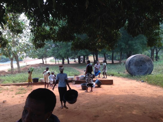
Testing the Timescape Bengaluru app at Kempegowda Tower in Lalbagh Park. Watch the video here

In November and December 2016 Rachel Lee and Anne-Katrin Fenk were in Bengaluru working on the augmented reality Timescape app that the Envisioning the Indian City team developed for Kolkata in 2015. Supported by Goethe Institut Bangalore (Max Mueller Bhavan) and MOD Institute, and partnered by Bygone Bangalore and Centre for Public History at Srishti, we spent five weeks looking through image collections, selecting locations, conducting interviews, geo-referencing photographs, writing entries and testing out and evolving the app in the city. We discussed our progress and the interim results at a public presentation at the Max Mueller Bhavan on 16 December.

ashoka-pillar

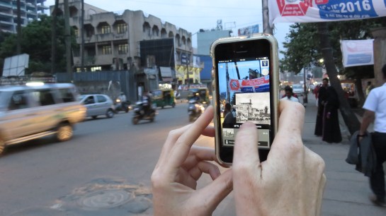
Real time transparency corrections at the Ashoka Pillar with Martin Winchester of Liverpool University

Timescape, a smartphone/tablet app, draws on the real, existing fabric of India’s cities, combining it with archival image material and historical data to communicate urban heritage through an immersive augmented reality experience. Using geolocation services and push notifications Timescape is a serendipitous tour guide, an armchair heritage portal, and an educational resource. Informative and easy to navigate, the AR app brings evocative, vintage photographs from museum collections, such as the British Library, online databases, like the Facebook group ‘Bygone Bangalore’, and family archives to India’s streets, living rooms and classrooms. Images of tangible heritage, such as buildings, are complemented by documents relating to intangible heritage, for example music recordings, poetry, and recipes. Timescape aims to become an innovative forum for recording, exchanging and remembering the evolving urban cultures of Indian cities across the subcontinent. Timescape will develop an infrastructure that enables people to upload their own historical photographic collections and stories.

avenue-road

Screenshots of the app taken while walking up Avenue Road

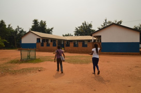
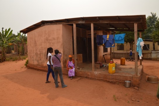
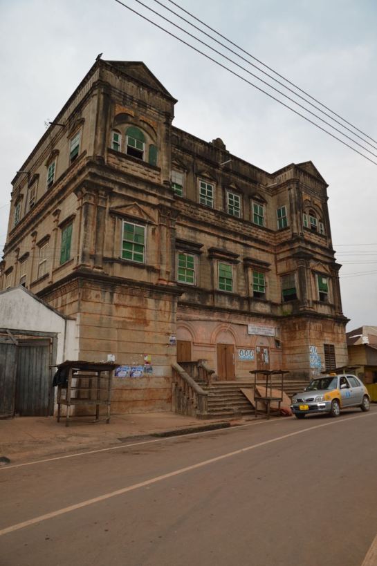
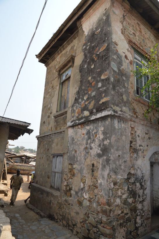
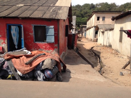
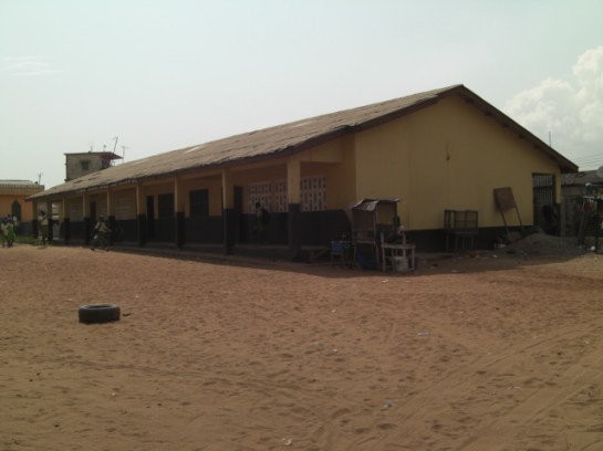
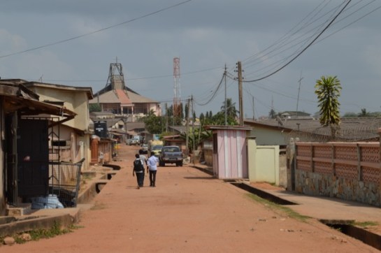
As Bengaluru continues growing at an unrelenting pace, the historical fabric of the built environment is increasingly threatened. When, for example, nineteenth century bungalows are demolished to clear space for office towers, places that contribute to the foundations of the city’s and its citizens’ sense of collective identity and public memory are destroyed. In Bengaluru we focused on a central area including Chickpete, the Fort, Jayanagar and MG Road, which is particularly threatened by redevelopment. Features on buildings, such as the Rice Memorial Church or Krishna Rao Pavilion, were augmented by cultural institutions like the Indian Institute of World Culture, monuments like the Ashoka Pillar or the statue of Maharaja Chamarajendra Wodeyar X, and legendary local cultural hubs such as MTR Tiffin Rooms, Vidyarthi Bhavan and Koshy’s. As well as historic images, textual descriptions accompany the points of interest and in some cases sound files were added. We would like to expand the app to include edited oral histories collected in the neighbourhoods. Some of the points of interest have been archived on the MOD blog.

map-copy

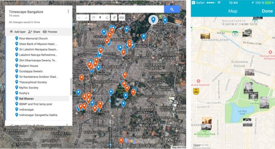
Google map showing chosen points of interest and a screenshot of the app showing geolocated images in map mode

The presentation at Max Mueller Bhavan began with Anne-Katrin Fenk giving an introduction to archiving and curating urban history. Rachel Lee followed with a report on how the time in Bangalore had been spent and what progress we had made on the app, then Kiran Natarajan of Bygone Bangalore talked about the need for the app through his rather amusing “shock therapy” presentation, and finally Avehi Menon from Centre for Public History discussed the importance of oral history and how it could be integrated into the app through sound files.

In 2017 the next step is to apply for funding to move up a level and be able to devote adequate time to the development of the content and technology. We have a great team in Bengaluru, Berlin and Liverpool who are very enthusiastic to take it further.

after-presentation

The Timescape Bengaluru team and friends celebrating in Indiranagar after the presentation at Max Mueller Bhavan. From left to right: Kiran Natarajan, Anne-Katrin Fenk, Avehi Menon, Katerina Valdivia Bruch, Vivek Jain, Cop Shiva and Rachel Lee

A short video of Anne-Katrin Fenk and Kiran Natarajan testing the app in Lalbagh Park is available on youtube.

Article in the Times of India from 20 December 2016.

Article in The Hindu from 10 January 2017.

img_0133-kopie

img_0060-kopie

Adjena Revisited

Ola Uduku writes;

It was a long and dusty journey, we soon understood why the taxi wouldn’t haggle down from the amount he quoted. The road definitely existed, it was just in very poor condition and work was being done near the end of the journey to Adjena to re-grade the laterite. We finally pulled into a gathering of housing on each side and slowed down, I said this looks likes ‘tropical designed housing’.

dsc_0456

A hand-operated water pump caught our eyes and we watched a small gathering of  women and children pump up their water into buckets and containers and then take them away for use.  We walked to two elderly men dozing under a tree and asked the throng if we could wake one up.

img_0727

‘Is the Adjena resettlement area?’, we asked.

‘yes’ came the reply.

Our first informant was in his eighties and  had arrived when the first set of resettled villagers were moved to the site in 1957. He explained that there was a school further along and more housing.

We went further into the clearing and hit gold – a small school designed around a courtyard to specific tropical standards. Windows were deep and allowed light to penetrate through the classrooms, and the verandas were ample to enable their use in teaching.  The school was foregrounded by a number of trees which seem to have been planted to a specific format, unfortunately they seemed to be dying, but they still helped frame the school and looked as if they were very much part of the school grounds.

dsc_0439

Moving on from the school we came to a clearing with a designed kitchen–cooking area central to a number of small dwellings. We stopped and talked to Agnes, whom we asked about what she remembered about moving to Adjena. She immediately recounted that she had been 27 when the move had taken place and she was 87 now. A quick date check confirmed that these dates tallied with the move of the settlement in the Volta valley to Adjena. As we chatted with her on the step to the kitchen she explained that she preferred the new settlement to the old as the new buildings were  ‘Cortex’, the name given to the company who built the settlement made up a concrete frame with infill breeze block walls.

dsc_0443

We passed a number of small dwellings designed as part of the scheme. All dwellings now had electricity with television sets to prove it, however water was only available via the standpipes that we had seen when we walked into the settlement. The communal WCs did not seem to well used, one supposes that in this very remote rural area this option was unlikely to be popular.

For a resettlement scheme approaching its 6th decade Adjena was in good condition, it now had a junior secondary school and the road carried both the electricity lines and also the mobile phone masts. The road also ran through to the community council offices and there were other settlements which were now part of the greater extended Adjena community.

Developments were coming to Adjena, and we had been made welcome guests to this sleepy, yet thriving community. What would Leo De Syllas and the other designers of the then New Adjena think of their creation more than half a century on? An understated success we’d say as we made our dusty way back to the town.


Field Work: Axim and Dixcove

Heading west from Takoradi along the coast-road towards Côte d’Ivoire there are a number of fishing towns and natural harbours, such as Axim and Dixcote.

img_0697

Dixcove Harbour

IMG_0692.jpg

Fishing Boats at Dixcove

Axim was a major port during the early 20thC, exporting £250,000 worth of goods in 1913, and the mail boat from Liverpool (as well as ships from the US, Germany and Belgium) called every 10-15 days before heading on to Sekondi. Before the British occupied the Fort at Axim (Fort St. Anthony) it was held built by the Portuguese in 1515 and then captured by the Dutch from 1642. The Fort was conceded to Britain, along with the other Dutch forts east of Elmina on the 6th April 1872.

A European hospital was established in the town in 1901, and the British Bank of West Africa opened a branch, having traded in Accra from 1897. There are still some colonial buildings to be found, and a photograph of the District Commissioner’s bungalow (c.1914) is held in the UK National Archives.

axim-bungalow

Type B Public Works Department Bungalow in Axim

Besides the Fort, the Quandahor Building dominates the town from its elevated position. The building (according to some sources) was built in the 1920s, but with what purpose and by whom?

dsc_0426

Quandahor Building in Axim

Nearby Dixcove also has its fort (macabrely named Fort Metal Cross after the slave branding iron used there) and the town still retains its thriving fishing industry. The fortress was constructed from 1683 by the Royal African Company and continues to resemble the 1806 print below. Needless to say, it is a harrowing structure, and a surviving relic of what must be one of the lowest points of British history.  By 1868 the Fort was under Dutch control, before being returned to the British just four years later. It was made a World Heritage Site in 1979 and has recently been inhabited by an Englishman intent on refurbishing the place.

phpthumb_generated_thumbnailjpg-2

1806 Print depicting Dixcove

DSC_0414.jpg

Dixcove Fortress

It was only in 1911 that a Customs Warehouse was completed and a market shed was erected in the Dixcove – is the image below the customs warehouse? A few other Colonial period buildings survive and we will endeavour to find out more about this fascinating place.

dsc_0423

The Customs Warehouse in Dixcove?

An Update from Takoradi, Ghana Part 2

The docks and rail infrastructure of Takoradi was the impetus behind its rapid expansion from a small village to a major town. Construction commenced after WW1, but before this took place, it was neighbouring Sekondi that dominated the area with its grand houses, trading offices and the plush Metropole Hotel. The Dutch established Fort Orange there from 1670 and the natural harbour provided a suitable place for light vessels to shelter whilst the surf boats manned by the Kru people brought goods and people ashore.

evernote-snapshot-20160720-121210-copy

The Metropole Hotel, Sekondi

There is some rich architectural heritage in this town, and clear evidence of a once prospering settlement full of traders and merchants. Those days are clearly gone.

We started with two schools, the first called Fijai, captured here by the UK National Archives Africa through a lens. Then onto St. John’s, again the vintage photo below shows the clean lines of the school, when constructed c. 1955.


dsc_0383

St. John’s School, Sekondi

There have been further additions to the school including the striking church, donated by a Wisconsin family , with its large A-line structural frame,  finely detailed concrete casting, wooden ceiling and pre-cast screening. Next to St. John’s is Adiembra housing estate. There were revisions proposed for Adiembra in the 1944 Town Planning report made by Maxwell Fry and Jane Drew, but it is difficult to ascertain what impact this report made on the area, if any. However, we did spot some standpipes and washing stations that resemble those proposed by Fry and Drew in their manual, Village Housing in the Tropics, so perhaps this is evidence of their involvement.

dsc_0376

The Church at St. John’s School

We went onto the main street of Sekondi where the Post Office is located. We discussed this building in our chapter in Bremner’s Architecture and Urbanism in the British Empire, but were now shocked to see how the exquisite timber counter had been painted in bright blue gloss – destroying the previous display of tropical hardwoods. The rest of the street has only gotten worse since our last visit, with many of the former colonial buildings on the brink of collapse. Absent landlords coupled with a shrinking economy has left these structures vulnerable and economically unviable. Further sad news must be reported, as the modernist Sekondi Regional Library has recently been demolished and replaced with a new library.

Our final visit in Sekondi was to the coastal-road village of Ekuasie, laid out in 1912. This was an early attempt at providing worker housing and adopts the familiar grid iron street format, although far more loosely imposed than similar schemes elsewhere (such as Korle Gono). There are some later and grander additions to this village, including a set of houses from the mid 1950s.

img_0663

Ekuasie Housing Estate

We returned to Takoradi and explored the workers’ estate, mentioned in the PRAAD archives as the ‘labourers housing and school’ at the Zongo area. This is still a thriving area, Hausa was heard being spoken and the tiny streets eventually lead to a playground-cum-village square, overlooked by the Islamic school and Mosque.

cimg5294

Takoradi Zongo School

An Update from Takoradi, Ghana

We started at the Takoradi Train Station, completed by 1928 as part of the coastal rail and docklands development. The train lines were initially constructed to transport cash crops, minerals and metals from the northern agricultural and mining districts to the awaiting ships, sheltered in the newly constructed breakwater and deep water harbour. When we visited in 2012 the train station was completely derelict and not in use. Today we found it carefully restored and new tracks laid. The plan is to reuse it for a local transport network. We walked up the hill to the small commercial district made up of international banks and a post and telegrams office. The mishmash of styles reveals the incremental development, as well as the fierce competition between the banks eager to differentiate themselves from the competition.

The former European hospital clock tower up on the hill overlooks the banks and docklands, as well as benefiting from the cooling sea breeze.

We drove to the 1920s part of Takoradi, a major new town extension that was built to accompany the docks development of that time. This portion of the town was primarily for the African population, although it also contains the Lasdun designed Bank of Ghana [built 1957]. Lasdun was also the architect of the National Museum in Accra. The bank was vacant when we visited in 2012, but now it stands in a state of complete dereliction, its fine materials and fixings being stripped from the building. This is a real tragedy. It was once an outstanding building, recorded in the Architecture journals of the day and surely one of Lasdun’s greatest works from this period.

img_0633

Somewhat downbeat, we bid farewell to the bank, and made our way to the rond-point in the middle of the town. The map was deceiving, as this was built as a major market place – our driver told us it was one of the largest markets in West Africa. It had the feel of Kariakoo market  in Dar es Salaam, and also contains a delightful little PWD post office with its signage graphics still intact.

Adjacent to the market is Amanful Village. Laid out in 1922-3 it is a mixed use area of housing and commercial properties. The basic PWD-type houses and layout remained in place, but more wealthy owners had transformed much of the upper part of the estate to suburban housing.

We then went to the Takoradi Technical Institute, shown above (Left, b+w) in the Africa Through a Lens Collection at the UK National Archives. There is a forcefulness to this scheme that takes the familiar two storey gallery access format, and emboldens into more ‘clunky’ yet determined architectural-structural forms.

dsc_0363

Nearby is the Effiekuma housing and the Effia Nkwanta hospital. The hospital has evolved overtime from a European hospital-cum-sanatorium in the colonial period, to a major health provider today. The careful layering and response to the site contours offers delightful views as well as a most welcome breeze to all the small structures that each have a view of the docks. At the top of the hill is a large brutalist extension that dates from c. late 1960s early 1970s. But who designed it?