Archive

British Colonial Architecture

New Research Paper: I. Jackson, O. Uduku, I. Appeaning Addo, R. Assasie Opong, “The Volta River Project: planning, housing and resettlement in Ghana, 1950–1965”, Journal of Architecture, vol 24 (4), 512-548.

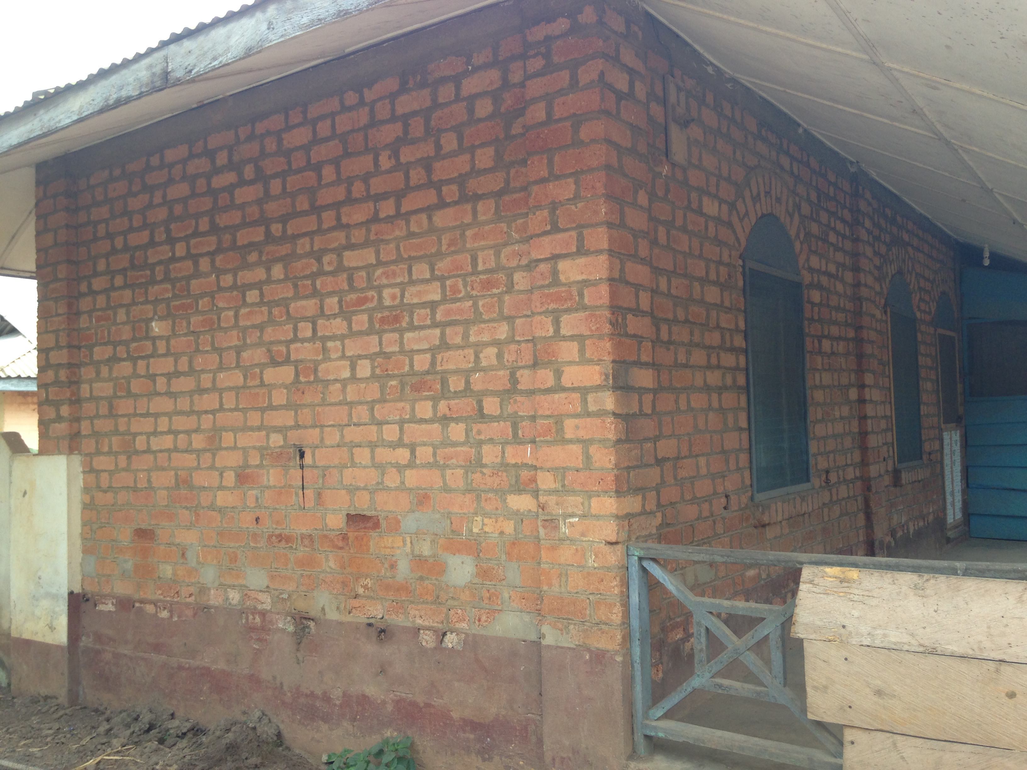
This paper investigates the housing schemes proposed in connection with the Volta River Project, Ghana, in the mid-1950s to early 1960s. The Volta River Project formed part of Kwame Nkrumah’s vision for Ghana’s modernisation and industrialisation in the wake of political independence. Three associated worker housing schemes demonstrated somewhat contradictory design and construction methods, from high specification, extensive amenities, and comprehensive servicing, through to self-build ‘core’ houses amounting to little more than single-room dwellings.

Figure 16.jpg

Core House at New Ajena, Ghana. Built c.1961, photographed in 2017

The paper traces the complex and controversial history of these schemes, supplemented with findings of several field trips to the settlements in question, to unravel the value of the ‘Core Houses’ approach. The most successful project to incorporate indigenous agency and true collaboration was the semi-formal ‘Combined Area’ housing at Akosombo, a positive model for shared agency and collaboration in planning, housing, and facilities delivery. Sitting alongside the carefully manicured plan of Akosombo, with its regulated market, excellent health care and desire to set high standards of cleanliness, the Combined Area has not only provided homes for the lower-paid and labouring workers of the town, but has developed over time into a settlement where professionals and retired government workers are also now residing, not out of necessity but by choice. By actively developing their own homes, shared spaces and amenities there has developed a strong sense of ownership, community, and identity. The success and level of attachment to this settlement clearly extends beyond its material presence and through the shared experience of helping to cultivate a place of one’s own.

Full Article Available here: https://www.tandfonline.com/doi/full/10.1080/13602365.2019.1643389?scroll=top&needAccess=true


Ng’ambo Atlas. Historic Urban Landscape of Zanzibar Town’s ‘Other Side’

Ng’ambo is the lesser known ‘Other Side’ of Zanzibar Town. During the British Protectorate the area was designated as the ‘Native Quarters’, today it is set to become the new city centre of Zanzibar’s capital. Local and international perceptions of the cultural and historical importance of Ng’ambo have for a long time remained overshadowed by the social and cultural divisions created during colonial times. One thing is certain: despite its limited international fame and lack of recognition of its importance, Ng’ambo has played and continues to play a vital role in shaping the urban environment of Zanzibar Town.

image3

Ng’ambo Atlas. Historic Urban Landscape of Zanzibar Town’s ‘Other Side’ documents the material collected through the heritage-based urban planning project Ng’ambo Tuitakayo! carried out by the Government of Zanzibar in collaboration with African Architecture Matters and City of Amsterdam and under the auspices of UNESCO.

image5-1

The goal of the project was to prepare a local area plan (structure plan) for the new city centre of Zanzibar’s capital. The planning exercises were from the beginning grounded in the notions of urban culture and heritage, while the principles outlined in the UNESCO Recommendation on Historic Urban Landscape provided a framework for the subsequent stages of the work.

It quickly became clear that the cultural and historic richness of Stone Town’s ‘Other Side’ merited a wider recognition than a technical planning document would allow for. At the same time presenting the outcomes of the project to a wider public through an atlas was a way to promote the history and culture of the area and contribute to the argument that urban heritage should play a central role in sustainable development of cities.

IMG_8074 bis

The atlas brings together and presents Ng’ambo’s rich planning history and draws attention to the outcomes of the mapping of the material and immaterial cultural landscape.It presents over hundred years of Ng’ambo’s history and urban development through maps, plans, surveys and images, and provides insights into its present-day cultural landscape through subjects such as architecture, toponymy, cultural activities, public recreation, places for social interaction, handcrafts and urban heritage.

Post 14

Ng’ambo Atlas was produced by the Department of Urban and Rural Planning, Zanzibar and African Architecture Matters

Editors: Antoni Folkers and Iga Perzyna

Publication year: 2019

Available for free download from:

https://catalogue.leidenuniv.nl/primo-explore/fulldisplay?docid=UBL_ALMA51336909840002711&context=L&vid=UBL_V1&lang=en_US&search_scope=All_Content&adaptor=Local%20Search%20Engine&isFrbr=true&tab=all_content&query=any,contains,Ng%27ambo%20atlas&offset=0

Available for purchase at:

https://lmpublishers.nl/en/catalogus/ngambo-atlas-historic-urban-landscape-of-zanzibar-towns-other-side/

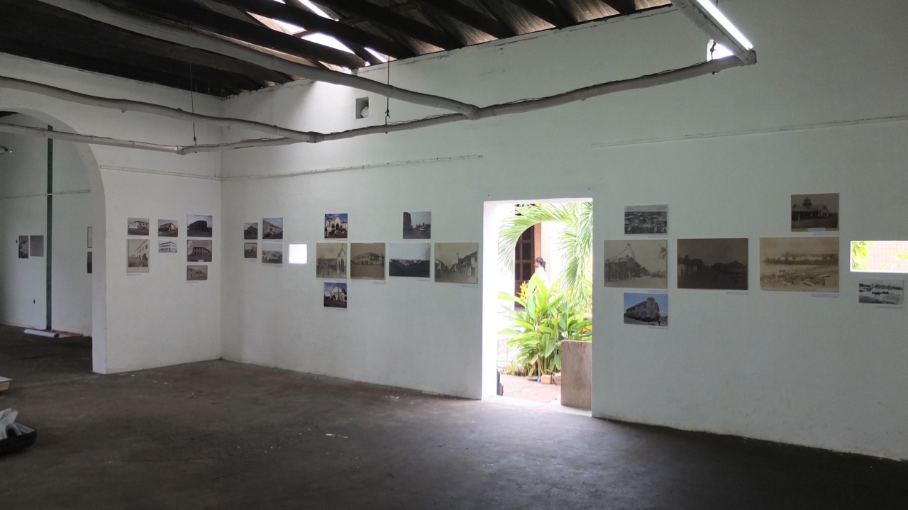
Thank you to Prof. Ola Uduku of Manchester School of Architecture for reviewing the ‘Sharing Stories from Jamestown’ exhibition. The exhibition has been extended to run until the end of June 2019. Below I’ve uploaded a 360 degree panoramic view – you can ‘click and drag’ the film to have a look around….

ouduku's avatarWARUH: West African Rapid Urbanisation and Heritage Conservation Research Network

Iain Jackson’s exhibition co-curated by Allotey Konuah-Bruce and Joe Addo opened to great acclaim on Saturday evening at the Jamestown Café, venue, near Ussher Fort. Curiously the café it was confirmed by local elders who attended the opening is accurately in Usshertown; the exhibition launch providing a great forum for these questions to be aired and for detailed discussions to be had.

Historic photographs and maps of ‘old’
Jamestown buildings have been placed next to those which show their age,
condition and use, in ‘contemporary’ Jamestown have been displayed in the lower
gallery of the Jamestown Café, which itself features in the exhibition as Tarquah
house, the dwelling and warehouse of one of Jamestown’s wealthy local
merchants, who had originally had it built. The exhibition represents a true
joint collaboration between Iain Jackson and Allotey Konuah-Bruce who have
formed a close and productive working relationship as they have spent the…

View original post 244 more words

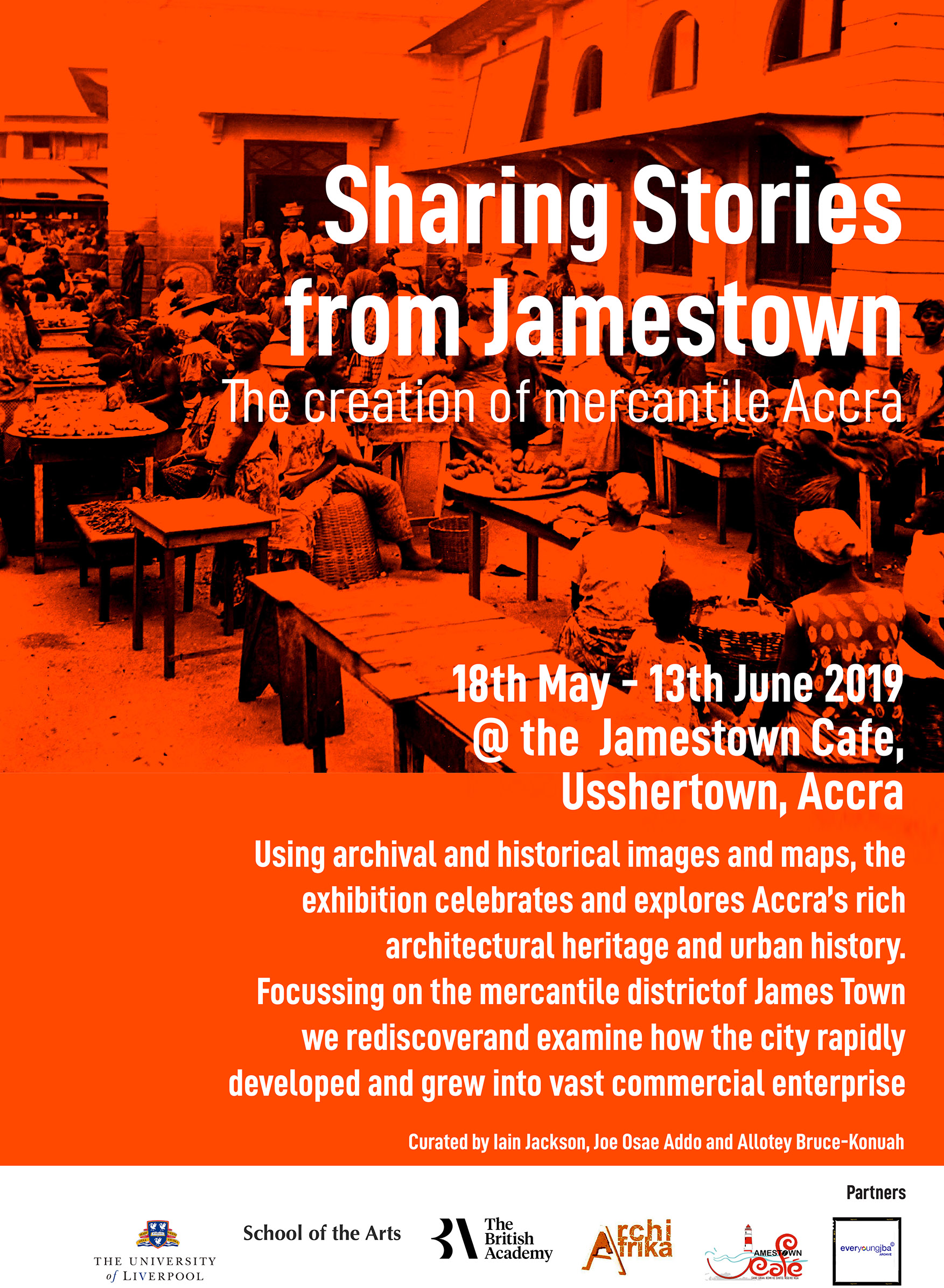
You are invited to our Exhibition, ‘Sharing Stories from Jamestown’, opening on the evening of Friday 17th May 2019 at Jamestown Cafe, High Street, Accra. All very Welcome! The exhibition will run until 13th June.

We’ll be exhibiting vintage photographs, plans and drawings from over ten archives and private collections that have been gathered together here for the first time. To accompany the exhibition we’ve also produced a catalogue that attempts to explain and contextualise the images, and to tell the history of Accra’s development, planning and architecture. You can read the digital version below. We’re indebted to Allotey Bruce-Konuah for expertly setting out the catalogue.

Exhibition Catalogue available at issuu: https://issuu.com/transnationalarchitecture/docs/sharingstories_accra_2019_jackson

We will include more photographs and 360 degree footage of the exhibition as soon as it is installed.

A. M. Martin & P. M. Bezemer (2019): The concept and planning of public native housing estates in Nairobi/Kenya, 1918–1948, Planning Perspectives, DOI: 10.1080/02665433.2019.1602785

Open Access PDF: https://doi.org/10.1080/02665433.2019.1602785

Estate lay-out Kaloleni, 1943, A.J.S. Hutton. Source: G.W. Ogilvie, The Housing of Africans in the urban areas of Kenya. The Kenya Information Office: Nairobi. 1944

Abstract: Interwar public housing estates for native citizens in Sub-Sahara African cities, represent hybrids of global and local urban concepts, housing typologies and dwelling habits.

The authors explain such hybrids via exploratory research note as a result of transmutation processes, marked by various (non)human actors. To categorize and compare them, Actor Network Theory (ANT) is applied and tested within an architecture historical framework. Nairobi/Kenya functions as pars pro toto with its Kariakor and Kaloleni estates as exemplary cases. Their different network- outcomes underpin the supposition that actor-oriented research can help to unravel a most essential, though neglected part of international town planning history.

Plan and elevation of two one-room dwellings, Kaloleni, 1943, A.J.S. Hutton. Source: G.W. Ogilvie, The Housing of Africans in the urban areas of Kenya. The Kenya Information Office: Nairobi. 1946

Maxwell Fry, the architect and planner of Ibadan University, considered the campus to be the highlight of his career, although he confessed that he found the Kenneth Dike library elevation too ‘lace-like’.

It is an extraordinary structure and we’ve covered it on the TAG blog previously, as well as printing a 3D sectional model of the structure. Taking a more retro step, I’ve now produced a hand-drawn (rotring, ink wash) front elevational drawing of the building (minus the small reading room on the RHS and smaller structure on the LHS, for clarity).

Kenneth Dike Library at Ibadan University, Nigeria

The drawing stretches over 2 x A1 sheets and has been scanned, pieced together, and the blue ‘sky’ added in Photoshop. I’m going to follow drawing with some additional studies into various libraries in Ghana – especially the Children’s Library in Accra (Nickson and Borys); Sekondi Regional Library (James Cubitt); Koforidua Library (also by Cubitt); KNUST Library (?) and the iconic Bolgatanga library by Max Bond.

Sharing Stories from James Town and the Creation of Mercantile Accra
Forthcoming Exhibition at James Town Cafe, 17th May 2019

I’ve been working in Jamestown, Accra to start planning an exhibition on the colonial and mercantile architecture of the district. Using archival and historical images and maps the exhibition will celebrate and explore Accra’s rich architectural heritage and urban history. The exhibition will focus on the warehouses, stores, factories and offices of James Town and examine how the city rapidly developed into a vast commercial enterprise.

The images for the exhibition have been generously provided by Unilever, Barclays, UK National Archives, The British Museum and private collections. Most of these images have not been exhibited before and we’re delighted that they will be shown in Accra, and in very close proximity to where they were originally taken.

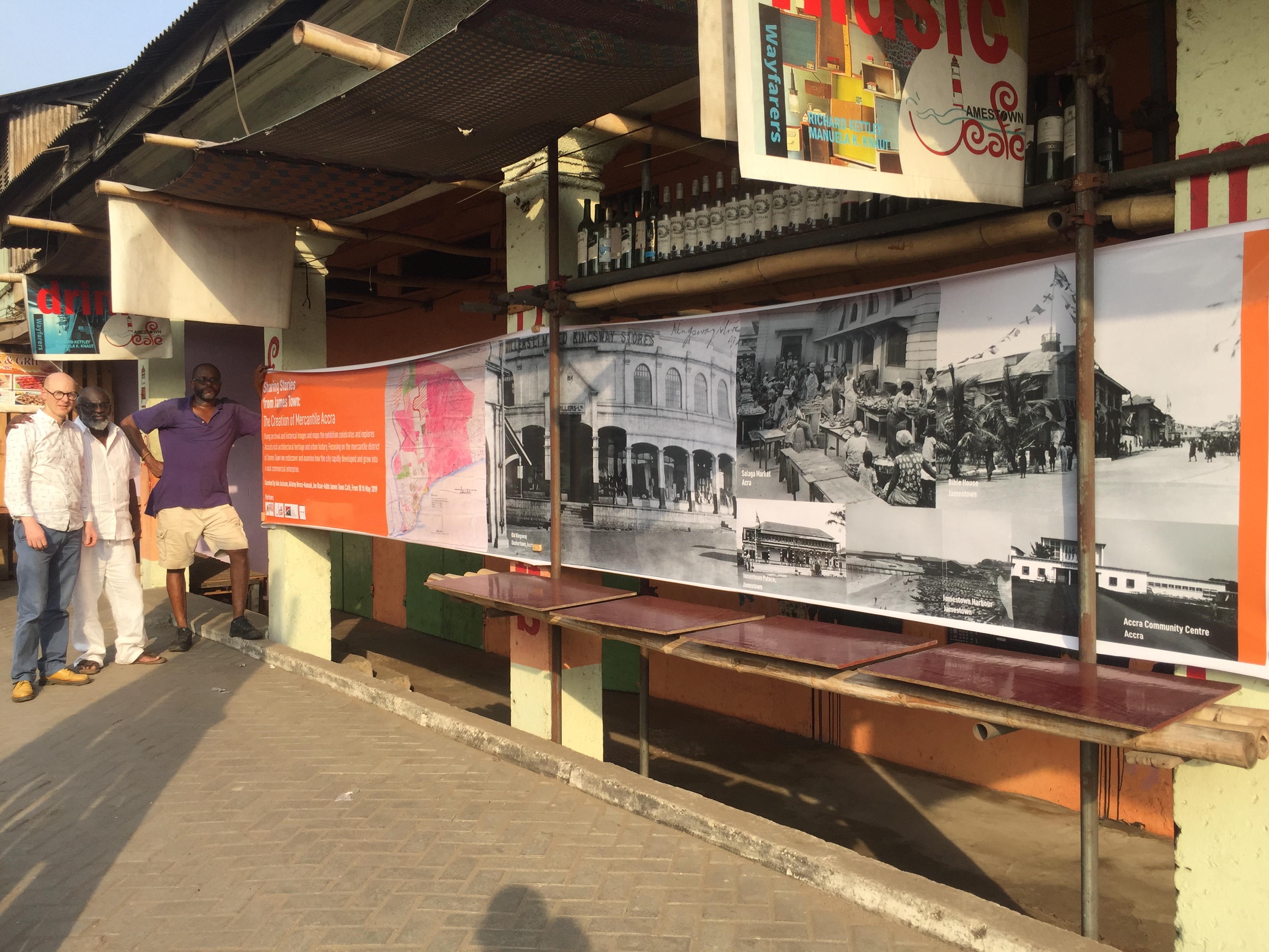
IMG_4426 (1).jpg

Exhibition Promotional Banner outside James Town Cafe with Iain Jackson [L], Joe Osae-Addo [C] and Allotey Bruce-Konuah [R]

There will be a printed/PDF catalogue to accompany the exhibition showing both archival and modern photographs of the buildings, along with historical maps, and we will hang large photographic banners of the archival images directly onto the historic buildings in James Town.

The main exhibition (co-designed with architect Joe Osae-Addo and designer Allotey Bruce-Konuah) will be hosted by ArchiAfrika at the James Town Café, from 17th May 2019. We’re also hoping that it will go on tour to University of Ghana (details to be announced). In June there will be an additional exhibition hosted at the James Town Café  curated by Lukasz Stanek and Ola Uduku of Manchester School of Architecture – and we’ll include more on both exhibitions here.

We’ve also started a new project to produce 360 degree panoramic photographs (and films) of some of the key sites and streets in James Town (and its environs). The images have been captured with a Ricoh Theta camera and we’ve taken over 200 photographs/ short films to date. The clips will be pieced together as a series of films and overdubbed with a commentary on the history and significance of the buildings in view. The films may be viewed with a VR headset for a more immersive experience. Allotey Bruce-Konuah already gives tours of James Town, and these films will enable his expertise to reach a wider audience, as well as encouraging new visitors to make the trip to this unique and highly important portion of Accra.


I’ve been spending some time working in and around Accra, and in particular at the Public Records and Archives Department. This archive has undergone major changes in the last five years and is a great place to undertake research with helpful staff and quick responses to queries. Located in a distinctive building with bold concrete brise soleil and a brave concertinaed roof over the entrance space, its interiors rely exclusively on passive ventilation. I was looking mainly at the late colonial records including those of the Public Works Department, sanitation, land, and town planning.

Experimental Swishcrete blocks at Kibi
Experimental Swishcrete blocks at Kibi from 1945
IMG_1003.jpg
Experimental Swishcrete housing at Kibi from 1945. Note the arches above the windows and doors

There were many discoveries and lots to celebrate (and eventually publish), but one particularly interesting find related to a folder called ‘Experimental housing at Kibi’. This gave lots of details on an attempt to build a couple of dwellings in swishcrete (i.e. laterite and concrete mix) blocks in the gold mining town of Kibi, with a view to saving on cement costs and also creating an aesthetic that was more in keeping with the vernacular. It was a particularly exciting find, as we had stumbled across these houses earlier this year, and were taken by their unique construction. The archives revealed that Jane Drew was involved in their design and that she visited the site in early April 1945. It must have formed part of her work on village housing. Although modified and extended the houses still stand and clearly demonstrate the strength of this construction method having survived over 70 years.

Outside of the archives, I managed to finally track down Denys Lasdun’s Paterson Simon’s Office in Accra, 1962 (thanks to the help of their current Managing Director John Traynor). It was formerly a supermarket and toyshop called Farisco.

I was hoping to see the Optimist Club in Sekondi, but as suspected, I was too late and the influential African club has been demolished and now replaced with a large youth centre. Fortunately, Nate Plageman did manage to visit the club before it was demolished and you can see his photos here. Despite this loss, it was good to use copies of the early plans of Sekondi from 1900-1920, housed in the UK National Archives, to further explore the town. I was particularly taken by the Venice Cinema located at the edge of the settlement by the lagoon (was this how the cinema got its name?) and the wonderful merchant villas and stores that can still be found in dilapidated abundance throughout the town.

Venice Cinema, Sekondi

Accra continues to seduce with its array of late colonial structures and modernist set pieces. At Korle Bu just west over the lagoon from Jamestown the hospital dominates the landscape. The hospital forms part of the trilogy of projects developed by Gordon Guggisberg in the 1920s (along with Achimota Schooland Takoradi town and docks). The old hospital structures remain, looking almost like they did when built (and similar to the harbour board buildings in Takoradi) – as captured on Africa Through a Lens. The later brutalist addition to the hospital was by Kenneth Scott, looking more restrained and orderly than the edgier and abrupt Effia Nkwanta hospital in Takoradi by Gerlach and Gillies-Reyburn. If you visit Korle Bu hospital continue to walk through the grounds and head out to the staff housing, tennis courts and garden sanctums that lie secretly beyond – it is a hidden, gentile world of privilege that still manages to exist just a couple of miles from the excitement and paucity of Jamestown.


Korle Bu Hospital, Accra
Korle Bu Hospital, Accra photographed shortly after completion, 1928


The paper focusses on the planning of rural settlements by the Athens-based firm Doxiadis Associates (DA), a key, even if unrealised, project for Zambia’s nation-building and development efforts in the mid-1960s. In line with post-war discourses of modernisation, DA employed Christaller’s 1933-Central Place Theory and its abstract hexagonal geometrical model to organise different-sized settlements within a single spatial system. By introducing a hierarchical rural network over Zambia, the firm aimed to standardise rural settlement patterns and to formulate a strategy to alleviate rural-urban migration. DA’s top-down, large-scale approach even exceeded the State’s aspirations and the firm’s visions eventually faced two challenges: First, DA’s modernist planning was questioned by the social/ecological considerations as formulated by George Kay’s counterproposal on resettlement policy. Secondly, DA’s ‘urbanising’ visions for rural areas were forestalled by some of the country’s realities, which remained out of the planners’ field of control, and eventually called for more cautious responses to the realities on the ground. By exposing the challenges DA’s rural proposal faced, the paper ultimately contemplates the multiple, and even conflicting reactions towards Zambia’s rural settlement projects, and also adds nuances to the wider histories of rural development in Africa.

Full article here: https://doi.org/10.1080/13602365.2018.1458044